Category: travel
You are viewing all posts from this category, beginning with the most recent.
A Day in Reykjavik
A Day in Reykjavik
We left our beautiful seaside house and headed to Reykjavik for a day of city touring. We were very lucky in that our AirBnB host had our apartment ready for us by 11:30 so we had a base for the day as well as a place for the kids to crash and rest during the afternoon.
Our first stop after dropping our stuff was for an icelandic hotdog at Bæjarins. Its just a hot dog stand, but they are worth the walk and the wait. There were at least 25 people in line when we arrived. The line moves quickly. As there is not a lot to think about. The hot dogs come with fresh diced onions, some cruncy onions fried in the air frier, Icelandic Remolade, ketchup, and pylsusinnep ( sweet brown mustard). As we were standing in line we struck up a conversation with the lady in front of us who was a tour guide. I think she was really just charmed by Maren. She warned us that we really needed to try the regular hot dog. When Bill Clinton visited, she told us, he only had mustard, and we’ve never forgiven him!
After the hot dogs we all went our own way to explore for the afternoon. We saw the Viking ship sculpture and the big Lutheran church.


We also checked out Rainbow Road, and lots of shops and a few bars.
Dinner was at Bastard Brew and Food, just down from our apartment. Delicious delicious stake sandwiches, in a quirky atmosphere.

Time to head home
Well, it’s been a great trip, but it is time to head home. We have a night in Lisbon and then an 11AM flight to Philadelphia tomorrow morning.
This post is a bit of a mishmash of the last day, and some summary thoughts about random stuff. Maybe more about our Polestar EV than is really necessary LOL.
After driving toward Lisbon for a while we stopped about 45km from the airport to have lunch, which looked like it was in the middle of a field. Well, not a field but a vineyard. We had a really nice Tapas lunch. Calamari, Squid, steak a couple of different ways, and some nice wine in a very nice setting. One of the dishes was called Pica-Pau which I have the recipe for and will definitely try to make this summer!
Drop off at the airport was chaotic, but the metro to our apartment was fine. Although we learned on the ride that we didn’t have hot water in one of the bathrooms or the kitchen. After being ghosted by our first AirBnB host here in Lisbon this was a bit much, but this host did offer us the use of BOTH of her apartments. We don’t need hot water in the kitchen and we can do showers in one bathroom, so we’ll be fine.
We did get out and do a bit of walking around Lisbon, although we are all mostly tired of being tourists so our hearts were not entirely in it. We found a nice rooftop bar that had a view of the city and then a more non-touristy Italian place where the risotto was very good, and the tortellini with bolognese was ok.
Back to our apartment by way of a gelateria, a pastry shop, and a supermarket for a beer to watch the UCL final! On our way home tomorrow! Not happy that Real Madrid won. Boo.
As a postscript to this post, I’ll just recall a few of the highlights. I’m writing this from 40,000 feet as we approach the Atlantic coast of the United States.
- The hiking in Madeira, especially along the Levada at the beginning of the 25 Fontes hike. Also the lunch we had by the sea after that hike was amazing.
- Loved our meal in Porto at Taberna dos Mercadores. Delicious and fun.
- The wine tasting stop on the Douro was a beautiful spot to enjoy some good wine. The hike down the hill was not everyone’s favorite, but it will be a lasting memory!
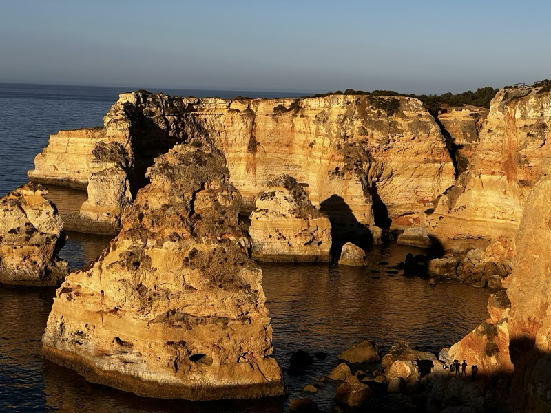
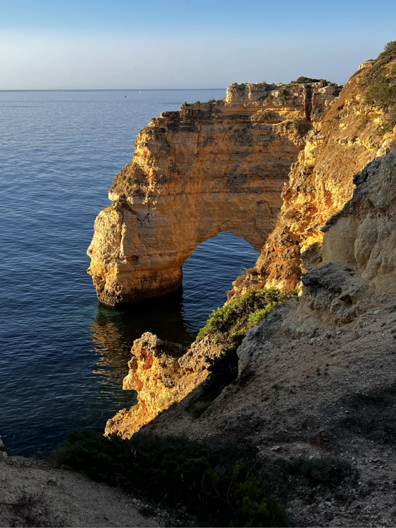
- Chilling out in the Algarve, and the morning light on the cliffs along the seven hanging valleys hike.
- The unexpected lunch stop in the middle of a vineyard on the drive to Lisbon. The steak sandwich and the Pica-Pau were worth the stop!
Renting the electric car turned out to be a fun experience. It was a bit nerve wracking a couple of times, but I think that was more to do with being in a foreign country and not having a backup way to pay for the power if the app wasn’t communicating with the pump. It was really nice to have the nav system show you the expected battery level at your next stop. For a long trip, like a drive to California, it would definitely make the drive longer, and require planning! Having a vehicle that was connected to the internet and had charging station locations integrated into the nav system would be great. Our rented Polestar had that feature, but the rental company didn’t have the car set up for internet access. So we ended up using the phone for finding charging, and the car for navigating. A bit frustrating.
I would certainly recommend time in Portugal if you are looking for a vacation option! We did a lot in a relatively short time. You could easily spend a week in Madeira all by itself. We didn’t get to see much of Lisbon, but that was OK for us as I’d rather be away from the city enjoying the green spaces.
Posting this from Minneapolis. Up way too early this morning. Going east to west always disrupts my sleep a lot more than west to east. But at 4am my body was saying that it was 10am in Portugal and that I was being very lazy for sleeping in!
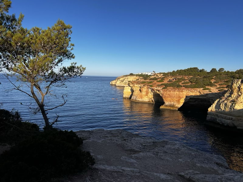
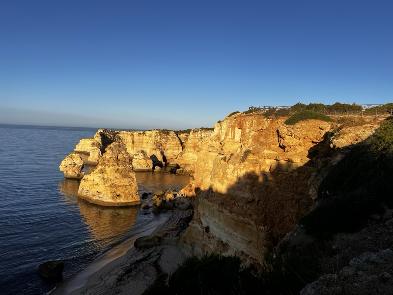
The Seven Hanging Valleys
This morning we were up early and out the door to do the seven hanging valleys hike. It is about 4.5 miles along the coast in Algarve. Each of the “hanging valleys” is really a cove so we have to navigate around or down and up each of them. Along the way are many chimneys where the limestone has eroded all the way down to a sea cave. We would have seen many of these caves if we had been able to do the sea kayaking the other day. Instead we will see them from above.
Jane drove us to the beginning and did the first mile with us before turning back and driving the car back to the hotel. Brian and I carried on.
Here are a few highlight photos.
Driving to Obidos and Ericeira
After our busy day in the Douro Valley it was time to head south! Our first stop of the day was the Europcar desk to pick up our electric ID3. But wait… we were upgraded to a Polestar 2! We had looked at all of the charging stations and decided this would be a great chance to try an electric vehicle! All was well until we arrived in Nazare - If you haven’t watched 100 foot wave you really need to watch a couple episodes! In Nazare it was time to recharge. Using the MIIO app, it was no problem finding a station, but getting the car to charge was like a clown show! Rookies! Two young American college students were trying to do the same thing, and it was pretty funny that we could not quite get it. We had all foolishly assumed that we could swipe our credit card and charge away! (Pun intended.) Instead we had to create an account on the app and preload it with some $.

With the car finally charging, we headed out for lunch and some sightseeing! We found a great burger stand, which was just what we needed after a week of enjoying mostly native Portuguese food. From there we walked to the lighthouse and enjoyed the views of the beach. There are no 100 foot waves this time of year, but it was fun to see the sights from the show in person.
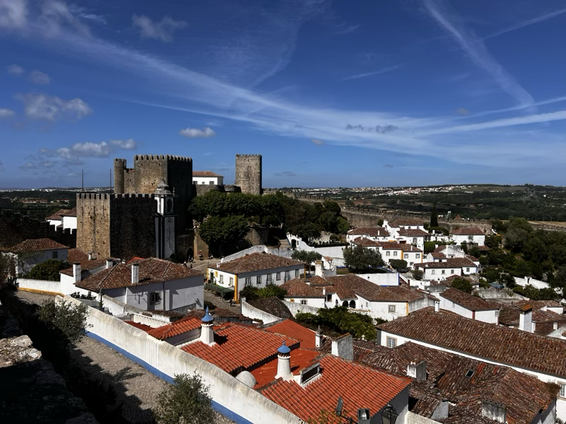
From Nazare we went to Obidos, this is a cool old walled town, supposedly the birthplace of Ginja. For me it also brings back memories of the early days of the internet and working with Amazon where the URL always contained obidos. Obidos was their original page rendering engine, named after a town in Brazil which is the swiftest part of the Amazon river. The town in Brazil was named after Obidos in Portugal. We walked the walls and enjoyed the sights from this little hill town.
After Obidos we headed to Ericeira for a two night stay on the ocean. We had a two bedroom apartment booked, which was upgraded to a four bedroom. Even better was that the parking ramp for the hotel had parking with free charging for electric vehicles! The hotel was lovely and we were too tired to do much more for dinner than eat at the restaurant in the hotel. The food was good.
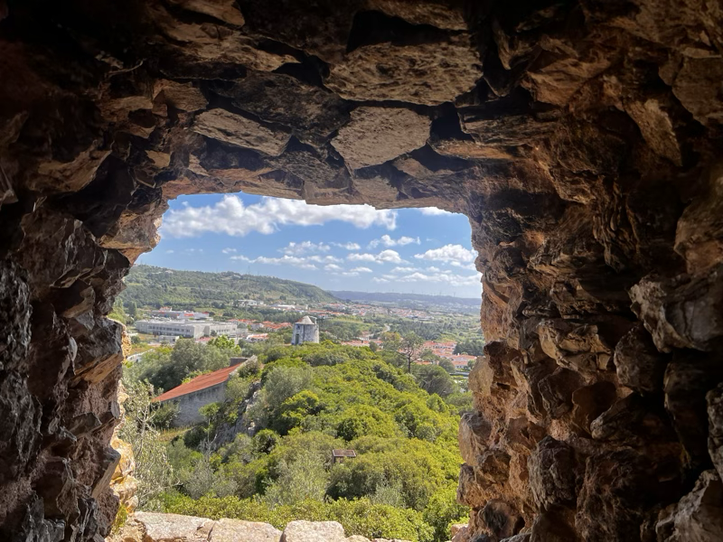
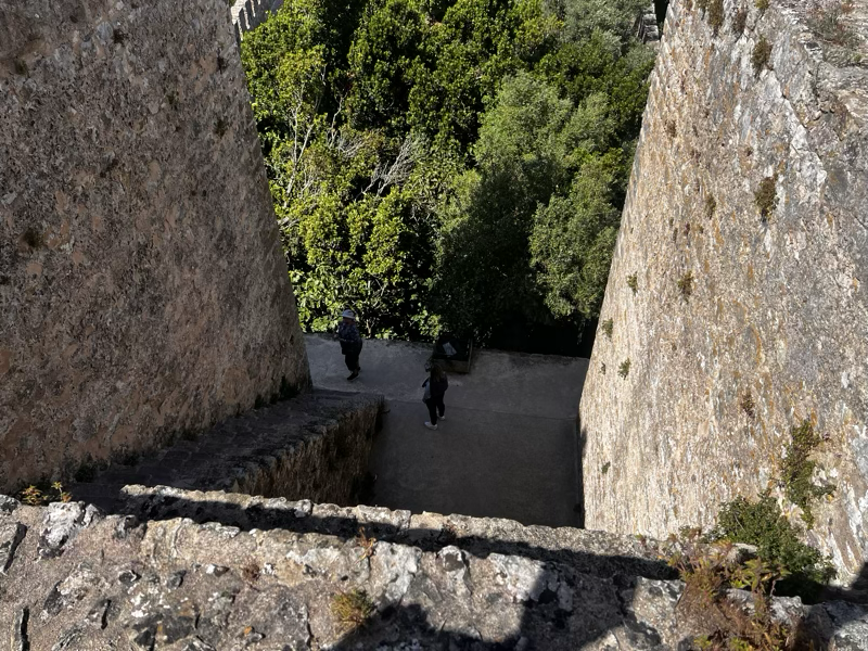
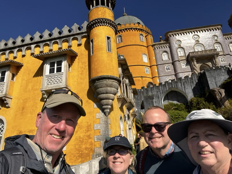
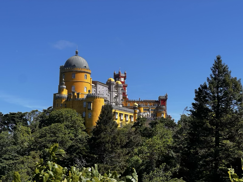
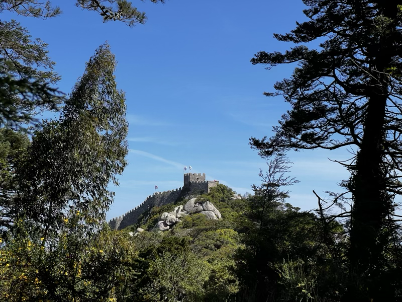
The plan for the next day was a day trip to the hilltop castle in Sintra, the Peña Palace. As we get older we get smarter, so rather than hike up the hill we used the Bolt app (Uber competitor) to get a ride to the top! Eight euros later and we were there! We walked down, but more about that later. The Peña palace is a huge sprawling complex with miles of hiking paths, castle walls, and a tour of the inside of the castle (which we skipped). There are other palaces and castles very close by including the Moorish castle. We enjoyed the hiking and sites of the castles.
Then it was time to see what we missed on the hike up! Boy are we glad we took the bolt instead of walking! As we were headed down a particularly steep section we met a couple coming up, breathing heavy and sweating. He asked “how much further?” I responded, “where are you going?” Expecting either Peña Palace or Moorish castle, the reply instead was, “to the nearest Uber!!” I laugh every time I think about that!
Holly had several options picked out for lunch and we ended up with a really nice one. Then back to Ericeira and some restful time by the pool.
Tomorrow we head off to Algarve for the relaxing part of the vacation!
Levada das 25 Fontes (alt)
This is our first full day on Madeira after flying Minneapolis to Toronto to Lisbon to Funchal, overnight, etc. etc. We powered through a half day of walking around town eating pizza and trying some local drinks. We had to go see the statue of Cristiano Ronaldo to see if it was as bad as it was in the pictures!

It was… Next ask yourself the question, why is his crotch extra shiny?? There is so much to do in Funchal, that I can already see we could have spent a week here easily. We did try the Madeira wine as we were walking around. Just eating our way through all the local places could take more than a week.
We all made it past 9pm! Today we woke up around 7am local time. 1AM CDT. We had an extremely aggressive hiking plan for today and immediately realized we had to tone it down. So we opted for the Levada das 25 Fontes. A levada is an irrigation channel or aqueduct specific to the Portuguese Atlantic region of Madeira. Basically they are small channels designed to bring the rain water from the upper elevations to the region around Funchal and other areas that need the water. We saw the water flowing through channels along the roads as we climbed our way toward the start of the hike.

The first part of the hike was great, it was right along the Levada with great scenery lovely trees and greenery. Quite an engineering project if you ask me!

After about 4 miles of hiking we found ourselves at the actual 25 Fontes part of the hike! The usual way to the start of the hike was just a boring walk downhill on a very narrow road. So this way was much better and more interesting. But by then we were pretty tired from the long rough descent, so we only did a small part of the original hike.

By the time we finished it was 2:00 in the afternoon and we hadn’t really eaten anything other than a few snacks. So we picked a lovely restaurant down by the sea to stop for a delicious lunch!

The view was amazing and the food was great also! Brian had Scabbard fish, Jane had baked Octopus, I had Portuguese black pork and Holly had Tuna steak. All deliciously prepared over an open fire. We all shared and all the dishes were really good.
By the time we got back to our AirBNB we were ready for showers and then happy hour. At happy hour we tried the Poncha and some Portuguese green wine, and a cheese plate. We played a game of Qwirkle at another local establishment and called it a night at 10pm! Tomorrow is another HUGE day of hiking.
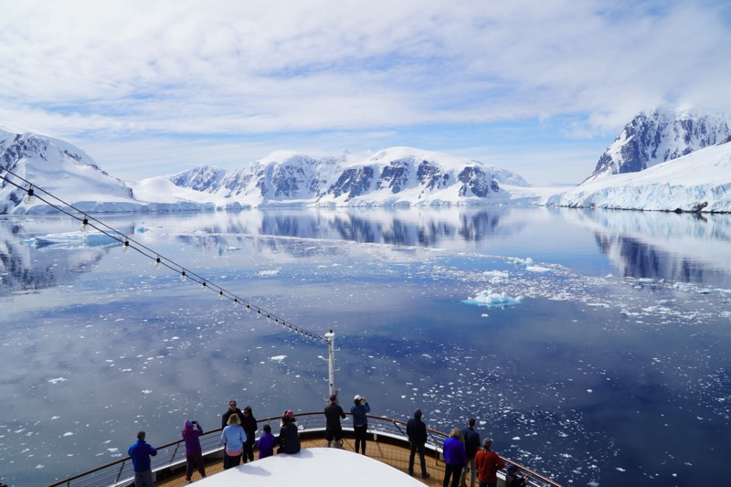
Andvord Bay
Our last zodiac adventure! 😭 But our first chance to put foot on the continent proper. Not an island off the content but the actual Antarctic continent!! 🐧The beautiful sunny weather of the morning had turned misty and cloudy by mid afternoon.

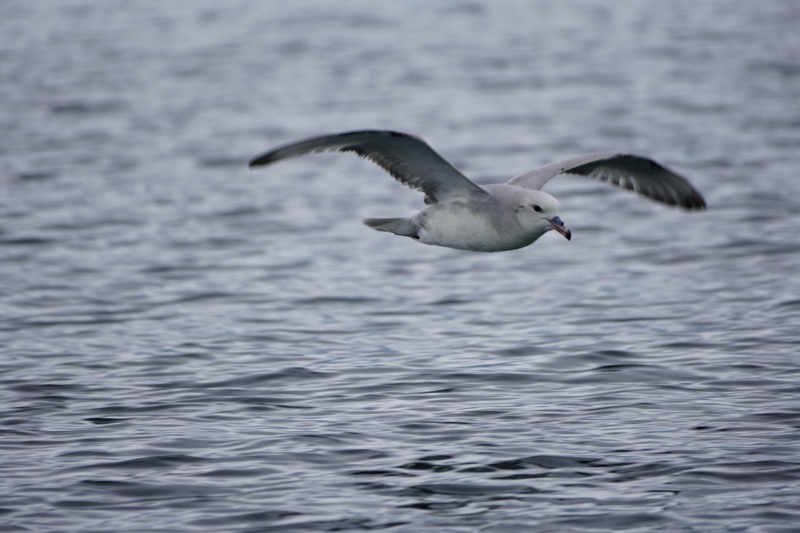
Lots of views of Gentoo penguins, and one lost Chinstrap!

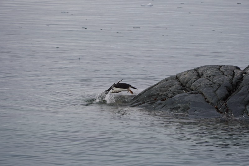
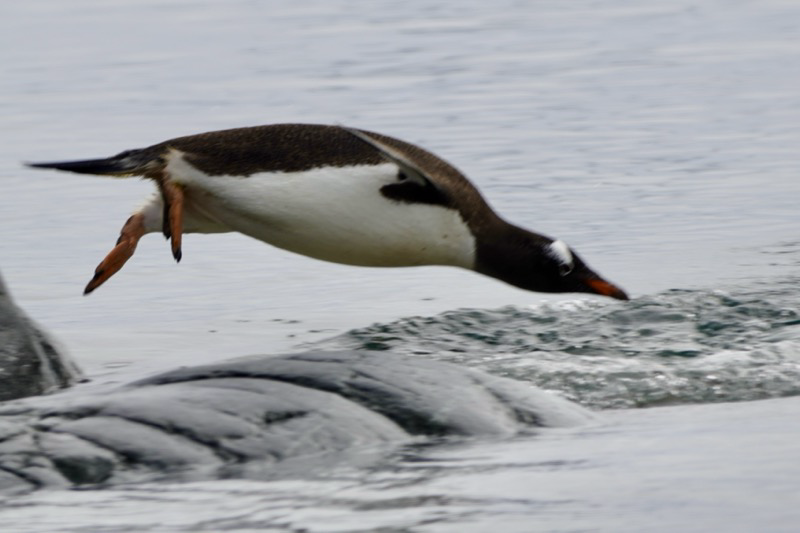
The Gentoos were coming down to the water to take a swim/much needed bath, and then got spooked by our zodiac. As we were sitting offshore we saw four of them swimming toward us. They were underwater but we could see them very clearly. Suddenly they swooped right under us and flew out of the water onto the shore. Nobody had a camera or video going or it would have been the most spectacular shot of the trip.
As we drifted away, I did get a couple great sequences of them diving off the rocks into the water.
Damoy Point
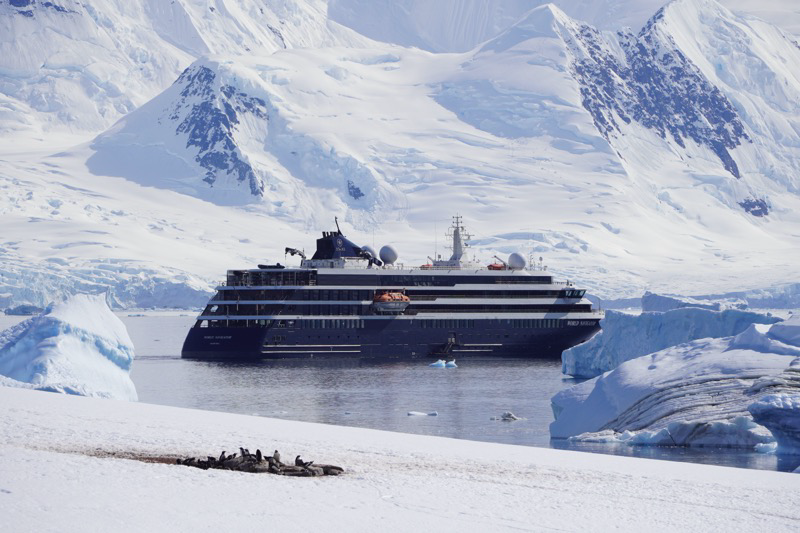
This expedition is just so amazing. Every time you think you have seen “the best” then another day comes along with another bay, or a change in the weather to a beautiful blue sky and you are just standing there once again wondering how can it get any better than this?
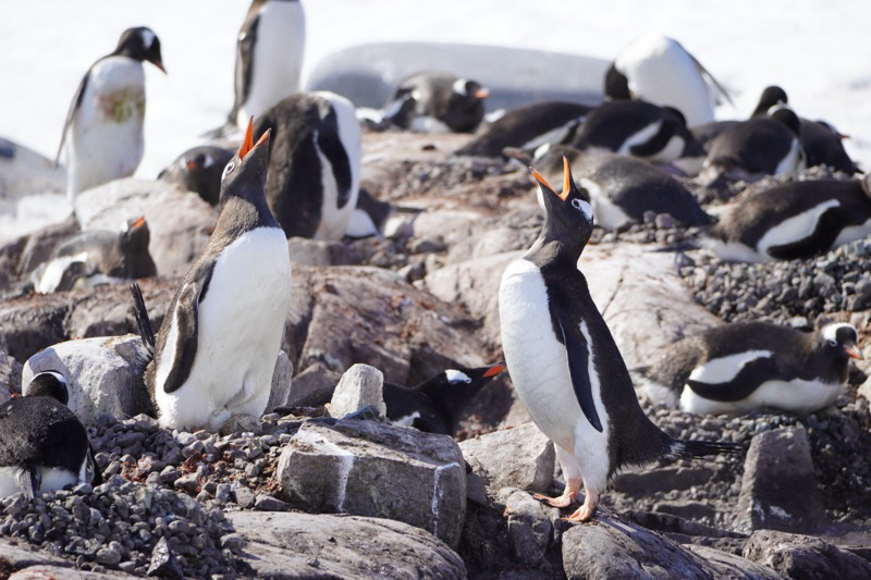
We started the day with a landing on Damoy point, home to thousands of Gentoo penguins as well as British and Argentine emergency huts. The British hut was open so we were able to walk inside and have a look.
The penguins were cute as usual, although a bit more pungent than usual if you ask me. The bay was just incredible with mountains on either side soaring skyward. At one point we were hiking and Jane and I both stopped because we heard “thunder” it was an avalanche in the distance somewhere. We didn’t see it, and according to Ignacio by the time we hear it the slide is already over anyway.


The really incredible part of the morning came after we were back on board and sailing through a big s-shaped area, the sun was out, the sea was dead calm and the reflections were beautiful.

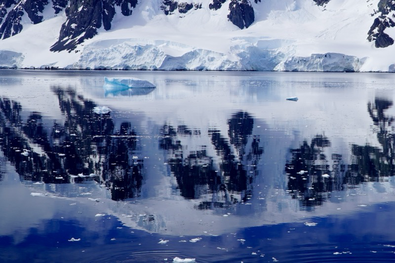
So many reflection pictures, and it was just incredible to stand there in awe of it all. Then along came some penguins swimming and diving in the water. It was amazing we could see them under the water as well as when they came flying out of it. Look closely at this picture there are three penguins!

Close up:

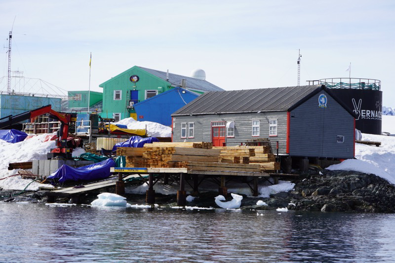
Argentine Islands
Antarctica is a continent. It is not “owned” by any nation, but is governed by an international treaty. Countries may maintain research bases in Antarctica but no country can claim a part of the continent as their own territory.
Today we got to cruise by a Ukrainian station. Under other circumstances we would have been allowed to visit the station, but unfortunately they were in the middle of a resupply process and could not accommodate visitors.
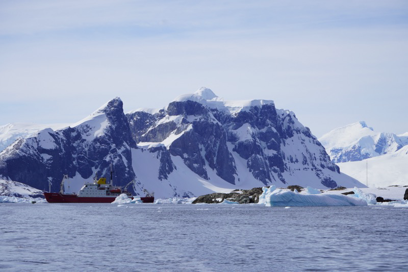
So, we cruised around and saw a little colony of Gentoo penguins. Visited an “iceberg graveyard” and saw some seals!

But the new animal for today was the Weddell Seal. Just lounging around on the ice pack.


The highlight of the afternoon will be cruising across the Antarctic circle. We were just commenting at lunch today that it was amazing how much we have seen but we have only seen a tiny tiny fraction of the continent. Everything we have seen and will see is part of the Antarctic peninsula that extends farther North.
Right now I’m watching a lecture on the Cetacians of the Antarctic. We have seen a lot of humpback whales, but there are also Minke whales, Fin whales, Right whales, and even Sperm Whales. Note that Sperm Whales are toothed whales not Baleen. Orcas are also quite common, including the ice pack Orca. This is a group of Orcas that engage in pack hunting. They will actually find a seal on the ice and attack the pack ice from below breaking up the ice and leaving the poor seal floating on a tiny bit of ice. From there they will push the seal off the ice and enjoy their lunch.
Yolaour Island
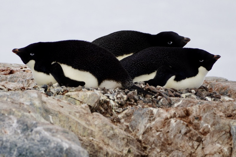
An easy afternoon to see some Adélie Penguins. So this is the third species of penguin that we have seen: starting with Chinstrap, then Gentoo (yes like the Linux distro) and now the Adélie. The Adélie is the only true Antarctic penguin.
The hike was easy and flat, and we were the first group this season to visit this large colony. We know that because our guides looked for a staircase from a previous ship and could not find one, so they had to dig one for us.
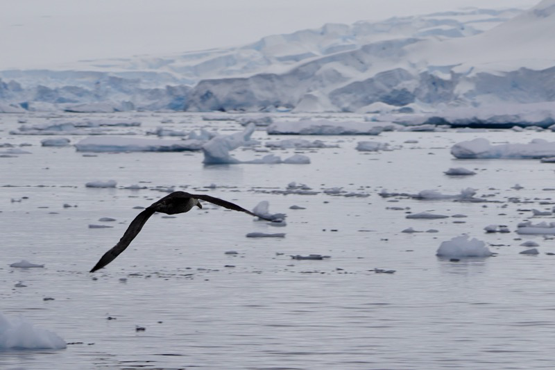
Our first bit of penguin drama came when the Skuas arrived. These are birds that are predators on the penguin eggs. They are very brazen predators as well, landing right next to the penguins laying on the nest! You can see it here with the one penguin looking quite alarmed, and the other just meekly pointing at the Skua as if to say “help?”

This guy however was definitely putting up a braver front! I got more of a “None shall pass” vibe.

But, the Skuas can’t be everywhere so there were plenty of additional Adélie to observe and enjoy their expressions. These three really got me.
Of course all is not just work in penguin land. I can’t imagine two penguins having more fun than these two little guys!

Finally, just a purely lucky shot. Our guide Ignacio has been talking about different techniques for composing shots and has talked about “frame in a frame.” I saw this from the zodiac heading back and thought it was a nice frame in a frame. It wasn’t until I got the photo onto my iPad and did a little cropping that I saw the Adélie in the middle of the frame!

Flanders Bay
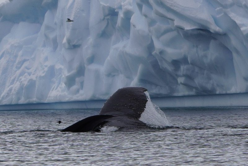
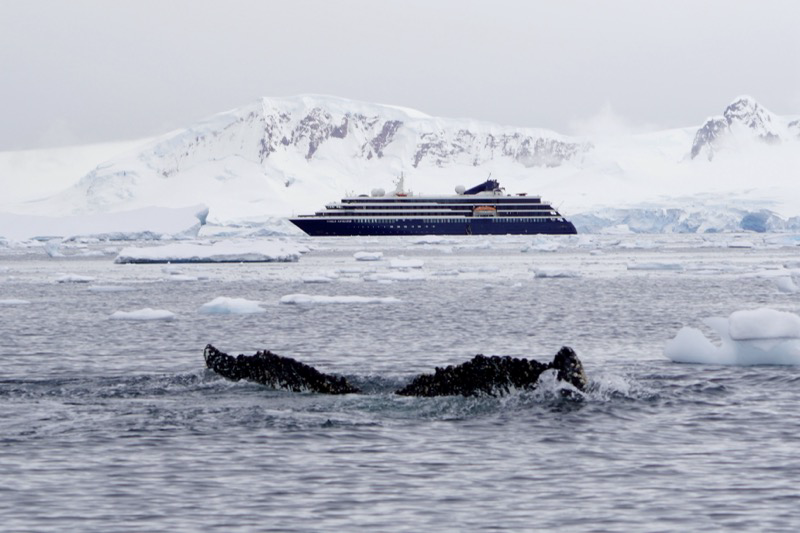
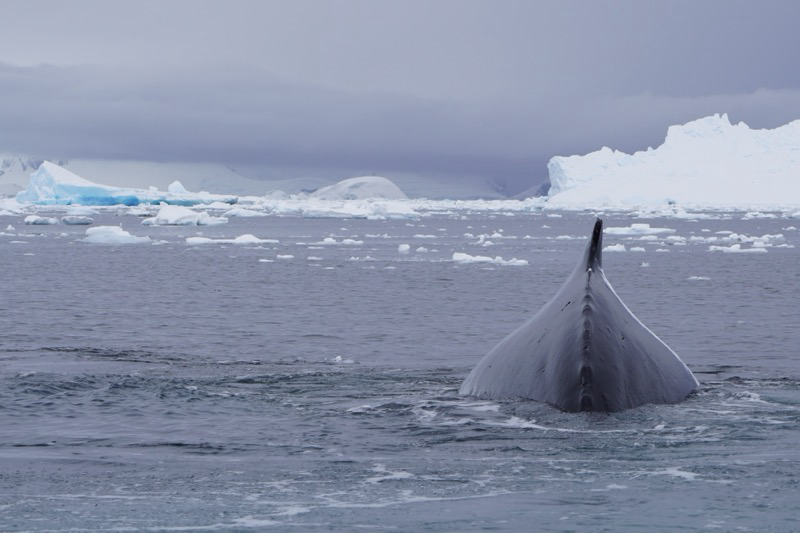
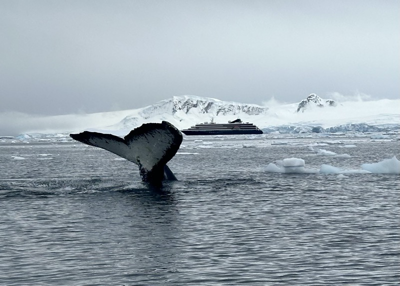
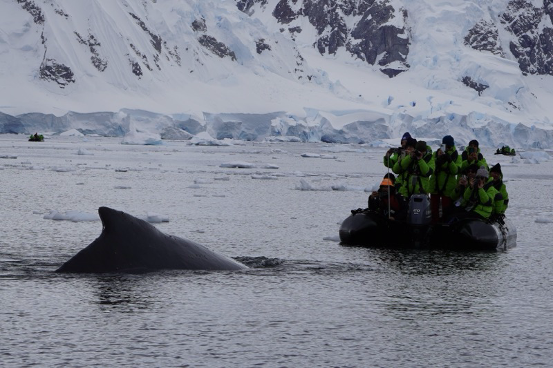
What started as an ordinary excursion turned extraordinary when we found ourselves surrounded by humpback whales!
We were just cruising through some brash ice and looking at some birds when we heard the radio call from Jonathan. “I am nine o’clock from the ship and have four humpbacks.” We quickly made our way toward his position, gliding in very quietly the last 100 meters.
Then we heard and saw them a short distance away. Breath going out the blowhole, whoosh. Sometimes they would just glide along the surface like a giant surfboard, sometimes they would arch their backs and slowly sink back under the water, sometimes they would dive and show their tails as they disappeared under the water.
At one point two of them headed straight at our zodiac. One went directly under the bow, the other surfaced on the starboard side so close we could have reached out and touched its barnacle covered skin. We have been whale watching several times, but we have never had an experience like this! So close, and the whales just seemed to be curious about “the intruders” into their beautiful calm bay. At some point I just told myself to put down the camera, put my hands in my pockets, and just enjoy this rare experience. Some memories will just have to live in my mind.
After returning to the ship and sorting through the photos from this morning I favorited more than 50! Gotta be a little more choosy for this post, so here you go.