Category: travel
You are viewing all posts from this category, beginning with the most recent.
Grand Teton - Cascade Canyon
The first ferry across Jenny lake leaves at 7am she said. We decided to shoot for the 7:30 crossing, which turned out to be a brilliant move. First we avoided lots of crowds, and second, we were up into Cascade Canyon in time to see a group of bull moose waking up!
One of the nicest hikes in Grand Teton is the Hidden Falls, Inspiration point, and Cascade Canyon combination. It is about a 480 foot climb for the first mile and then it evens out for the walk through the beautiful glacial canyon. By leaving early we avoided the people coming down the trail as we were heading up and it was generally a lot more peaceful.

The first stop was hidden falls, a beautiful waterfall on cascade creek that feeds into Jenny lake. The lake temperature is 60 degrees at the surface, “but gets a little more chilly if you dive down.” Not much chance of that happening.

A further climb leads you to inspiration point. On the way up this climb there are a couple of places to stop and take in some of the peaks in the Teton range. Including this picture of Teewanot. The contrast of the morning sun against the storm clouds over the peak was awe inspiring already. And yes we did hear thunder, but thankfully we did not see or experience any lightning!

When you arrive at Inspiration point you have a fantastic view of the lake. I love this shot that shows the ferry leaving the dock leaving a feather-like wake.

After inspiration point the trail levels out some, and so we were just enjoying a nice walk back into the Cascade Canyon. We caught a few raindrops as the storm clouds passed over us, but not enough to get wet. We happened to talk with a couple of guys coming down the trail who told us they had just seen a couple of moose laying in a meadow about 5-10 minutes up the trail. We were lucky enough to spot them when we arrived! It was a bit disappointing to see nothing but antlers, but It looked like they were beginning to stir so we decided to hangout a while and see if anything happened. During the wait we amassed a huge collection of very bad photos of moose antlers behind plants in the deep shade.
But sure enough after a 15 minute wait one of them stood up. This caused a second one to rouse itself as well. Eventually they ventured into some light bright enough to get a few decent photos. Although 99% of our photos are taken on iPhones these days we were glad to have brought along our old Sony A6000 with the telephoto lens to get a better closeup.

This little encounter reminded us how lucky you are to see wildlife while hiking along. The animals are so hard to spot if they are not up and moving. We often wondered how often we passed some kind of wildlife that was just quietly lying behind a bush a few feet away.
We continued further into the canyon now in hopes of seeing a bear (at a very safe distance). The closest we came to a bear was a surly teenager who ruined his grandma’s entire day with his behavior. A side note here - it seems that leaving early is a good strategy because it is mostly people our age on the trail and some families with younger happy children or cute babies in backpacks who get up early in the morning. We noticed a lot more teens on the trip down in late morning.

We arrived back at camp in time to make some lunch. I guess I really worked up an appetite because caesar salad with chicken never tasted so good. We voted for a lazy afternoon of reading, and checking out the beach. Around 4:00 we took a short drive up Signal Mountain to take in the views of the “hole.” Fun fact: The term hole was a common term to describe a high altitude valley. Further fun fact - the term “dude ranch” specifically the term dude was a pejorative term in the late 1800’s to refer to a city dweller who needed to be pampered and was very likely unable to look after themselves in the wilderness.
Mexican food so good…
Today (Day 2) was a day of driving across South Dakota. What do you see when driving across South Dakota? Billboards, lots and lots of billboards. Wall Drug, of course. But lots of others too, apparently the Firehouse Brewery is trying to be the new Wall Drug. They have signs and bright red fire trucks every few miles. Here are a few of our favorite slogans.
Mexican food so good that Donald Trump would build a wall around it!
I don’t even remember if the name of the restaurant was mentioned. But I would love to eat there to support the owners.
There is wisdom in wine.
There is bacteria in water
Love it, let’s have a glass of wine to celebrate the author of that sign.
I have to say that South Dakota is not a good value; it is pretty expensive scenery at almost $1.00 per mile! The reason that today was particularly expensive was the headwind. We were driving straight into a 20 mph wind gusting to 40 mph at times. Our gas mileage is normally 9-10 mph while pulling our camper, but today we were averaging 5.3. Yikes! I was beginning to think that today was our day for mechanical troubles until we stopped to fill up. I could hardly push the door open against the wind. Although relieved to understand why we were getting such poor mileage, Knutson’s van performed perfectly and with a diesel engine they were only using about a quarter of a tank to our 25 gallon fills.
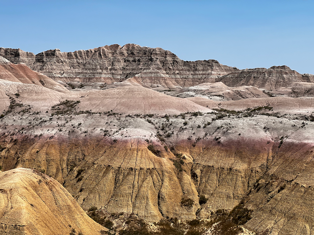
We made it to the Badlands in the late morning and took the scenic drive through. The last time I was on this road, I was on my bike, so it was a different experience to see it from the truck.
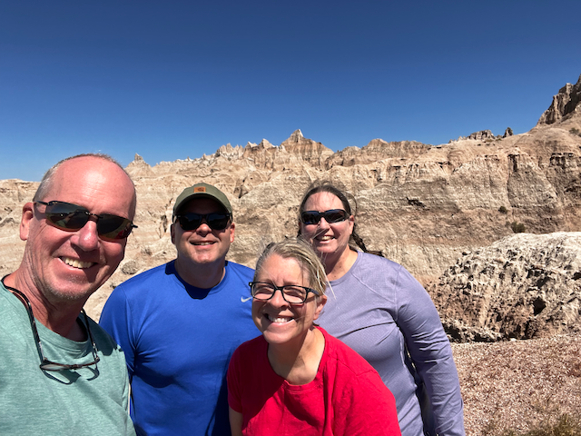
The Badlands are so interesting with millions of years of geologic history on display. They have a map that shows what things looked like all those years ago and clearly this part of the world was under water.
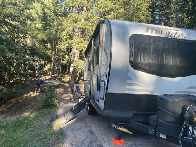
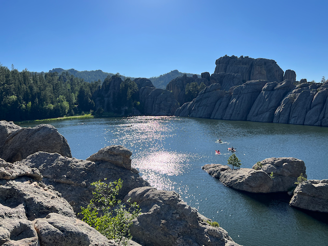
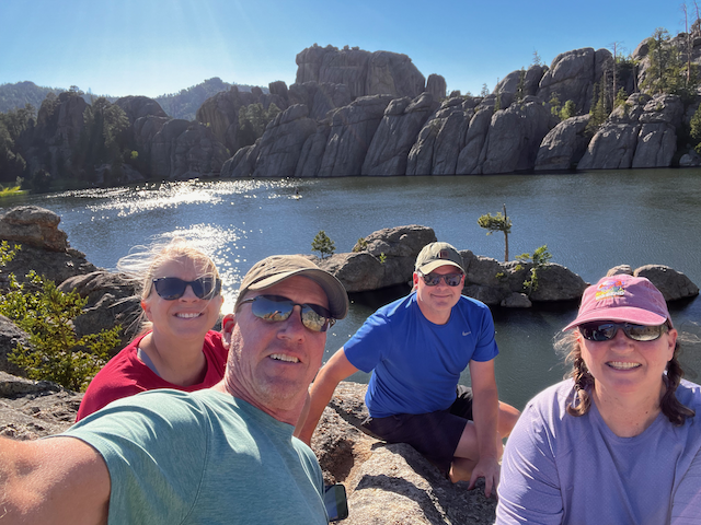
After we got through the Badlands our final 100 miles for the day brought us to Custer State Park. I think it must be one of the most beautiful state parks in the country. Our camp sight was beautiful, if a little small to back into. We set up camp at the Sylvan Lake campground and after a round of beers in the shade we headed out for the short hike around the lake.
Dinner was wonderful, we had some delicious french dip foil sandwiches. Holly had made them with cheese and roast beef and then wrapped them in foil, we put them over the fire and they came out perfectly. Meanwhile we took on the task of trying to figure out the problem with the gas supply to the grill and griddle. By process of elimination we determined that it was the quick connect coupler on the camper that had to be clogged. The protective cover had either come off or we had forgotten to put it on, so it wasn’t too surprising that road grime was interfering with the flow. We took it off and washed it good with soapy water. That cleared it all up and so we are back in business to cook with gas. However we are having fun improvising our cooking over the open camp fire.
Unsurprisingly holly and Brian had not slept very well their first night in their van, so we called it a night relatively early.
The Adventures Begin
Every five-ish years we have a special trip with our good friends Brian and Holly. We were all married on the same weekend in June, but one year apart. Brian was my college roommate and my best man. So to celebrate our five year anniversaries we do a trip together. We have been to Door County, Hawaii, the Mediterranean, the Caribbean, you get the idea. Every time we go it is an adventure.
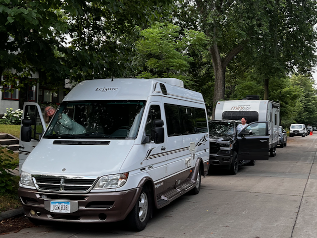
This year is our 36th anniversary and their 35th. A few years ago we rented a 32 foot RV and visited Banff and Glacier. This year, we decided to keep the national park theme going and are heading to the Grand Tetons and Yellowstone. Since we have a travel trailer, Brian and Holly decided to rent a camper van and we would drive and camp together.
We were about an hour down the road when we got the following text from Holly.
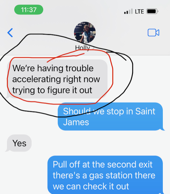
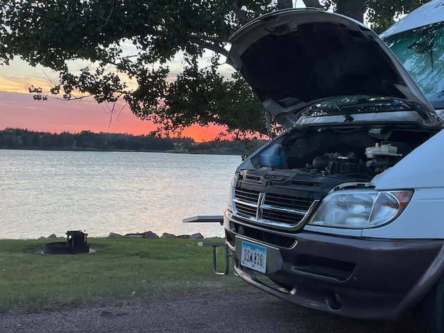
So we pulled off in Saint James and parked behind the Caseys. After turning off the van and restarting the engine everything seemed fine. So we continued on down the road. We got all the way to Heron Lake when it happened again. So we pulled into the Conoco station and they called their rental company. Once again restarting the van fixed the problem. After the third time we decided to pull over in Worthington and get some help from the rental company. The first thing we learned was that the roadside assistance provided with the rental was completely useless. They said they found one place that could help us, in the little town of Lismore, that could get us in on Wednesday! Discussions ensued with the owner of the RV who seemed pretty knowledgeable and correctly diagnosed what the problem was. Meanwhile the rental company got busy trying to locate an alternative RV to bring to us. The RV was in “limp mode”. When the RPMs exceed 2700 the turbo is not able to keep up and goes into a mode where you cannot accelerate.
At the owners suggestion we continued toward Sioux Falls, with a stop for gas in Luverne where gas was just $4.09. While we were in town we made a quick stop at Papik motors where we were able to get the error code read, which confirmed the diagnosis. A little further down the road we got word that we should head to Chris’s Auto Repair in Sioux Falls. If you ever need some work done on your car in Sioux Falls I would highly recommend, they are the nicest group you will find. They did some more diagnostic work to figure out exactly what needed to be replaced. Unfortunately they couldn’t get the part until Wednesday, so the owner dispatched his mechanic to make the four hour drive to Sioux Falls with the part. We now knew that we were not going camp in the badlands, so we found a couple of sites at the very nice Lake Vermillion recreation area.
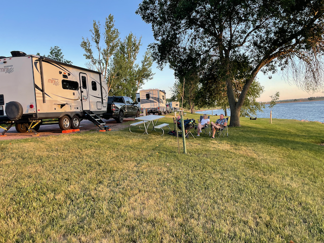
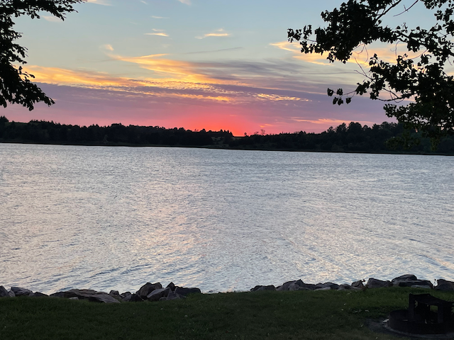
While waiting for the mechanic, we had happy hour and made some burgers. We were planning on grilling, but for some reason could not get the grill to light! Another mystery to figure out when we get settled in Custer. The induction burner and frying pan worked out just fine, so we had our burgers and enjoyed the views of the lake.
At around 9:00 the mechanic arrived, well it was actually not the mechanic but someone’s teenage son. Whatever! He got the job done and the RV has been running like a champ all day today.
Driving to Page
Today was mostly just getting from Zion over to Page Arizona. We had to take the camper through the tunnel, which was interesting because they make the tunnel one way traffic whenever there is a camper or bus that needs to go through. The road is just a little too narrow for comfort and although two campers could probably pass each other many mirrors would be broken. From there we went through Kanab and then onward toward Page Arizona.
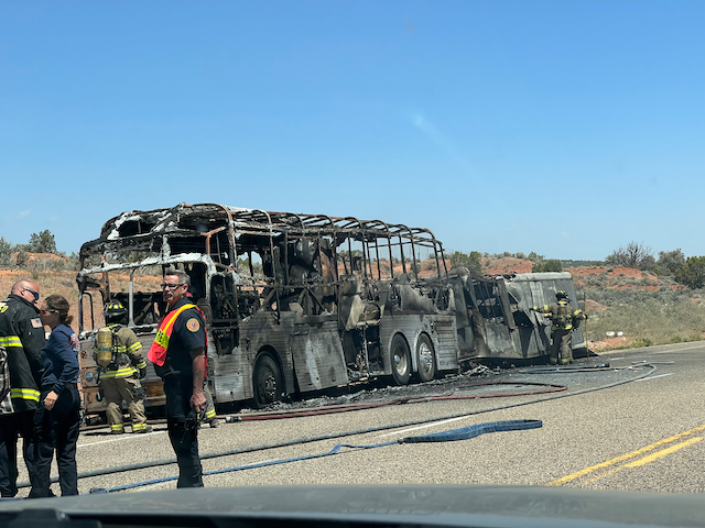
About 20 miles outside of Kanab we came to a sudden stop. There was a huge lineup of cars on our side of the road and no oncoming traffic except for the few cars we could see turning around. With no cell service it was a total mystery as to what had transpired ahead. We assumed it was an accident of some kind. But how long would we have to wait? After sitting some time the paramedics from Kanab came by heading toward the accident, so we knew it would be quite a while. Jerry and I decided to take a little hike up the road to see if we could find any information or even just to see if we could see the start of the backup. After walking about a mile we started chatting with another person who said that there had been a lot of smoke and the word was that a camper had tipped over and caught fire. Rescue crews were looking for volunteer vehicles to help clear the road. But nobody knew how long it would be before we could get underway.
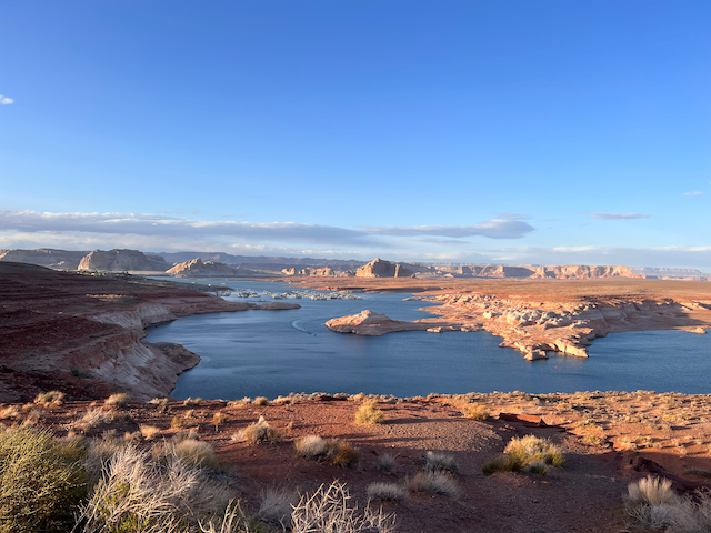
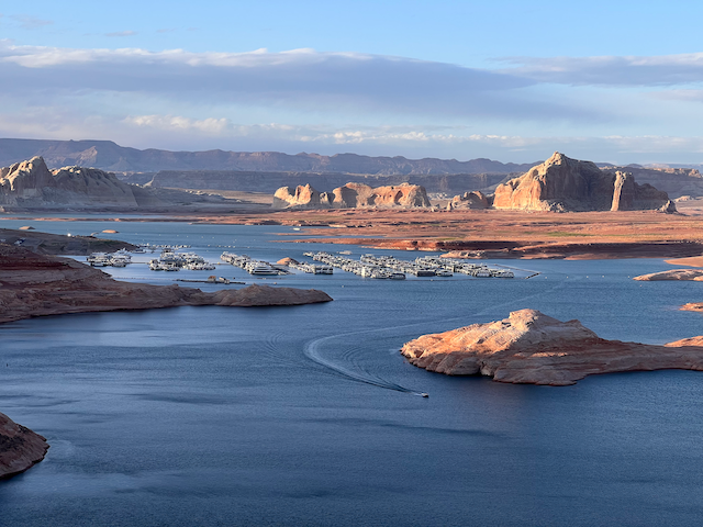
We met people with timed reservations at Antelope canyon, and others on their way to Lake Powell every car on our walk back wanted to know if we had learned anything. We we tried to tell what we knew in ever decreasing detail. A few minutes after getting back to the car we could see the front of the line start to move. It was just about 1 hour delay. Luckily we were not on any time schedule. We could clearly see the problem when we got to the front! We hope everyone survived! This really made us think about the dangers of driving in remote areas, no cell service in this area? We can only imagine how long that RV burned before word got to the authorities and someone was able to respond 20 miles from the nearest town!
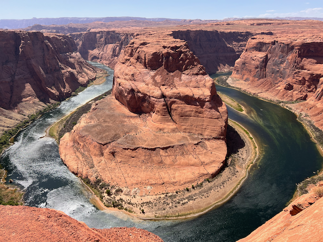
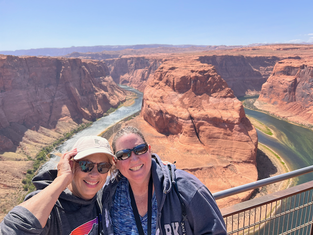
The other unfortunate thing about the day was that the wind was just howling 20 mph with gusts of much more. At our campsite we could hardly close our door with both hands! Needless to say we were not going to sit around in the camper in the wind, so we headed down to see horseshoe bend. It takes a bit to walk down to the viewpoint and on the way there we had convinced ourselves that the wind was letting up a bit. But when we got to the edge of the canyon overlooking the bend we were sand blasted! You could hardly stand it with the bits of sand and gravel whipping around and stinging your skin.
So maybe outdoor hiking is not a good idea today either. Maybe we should go into page to the brewery and distillery? That turned out to be a great call. Good beer, decent pizza and some really nice gin — made with botanicals. Yes, I am on vacation I had gin and beer.
Back at the camper the wind had calmed down so we settled in for a rousing game of “Mexican Train” dominoes. It was a game full of twists and turns, just when we thought we had it figured out Jane staged a dramatic last minute victory.
Zion Narrows - I Know how to Save a Life
Suddenly floating
Down the river goes my wife
Someone grab her hat!
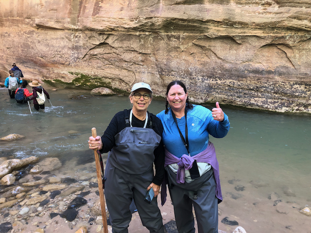
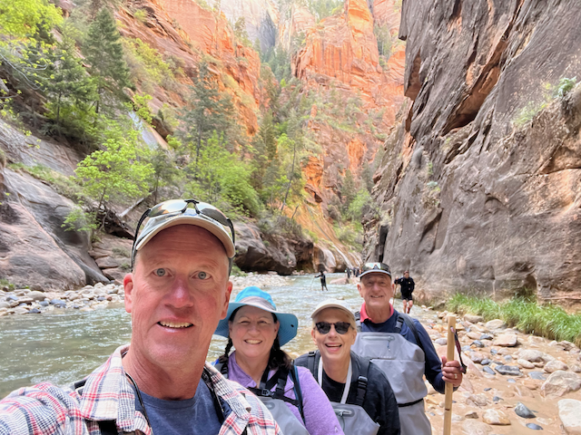
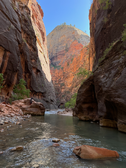
It was a beautiful morning in Zion National Park, we were up early to get to the outfitters to rent our waders/dry suits for the hike in the Zion Narrows. This is a hike we have wanted to do since 2009 when we brought the kids with us to Zion. It was worth the wait and is definitely in my top 10 list of hikes.
The water temperature was 56 degrees and the river was flowing at 46 cubic feet per minute. So it was not too high, but it was rapid enough that a lot of the time we really needed our poles to stabilize ourselves. I was under the impression that the entire hike was in the river. Thank God it was not. A lot of the hike involves zig zagging back and forth to get to dry land to walk on a trail for a short distance before going to the other side to do the same.
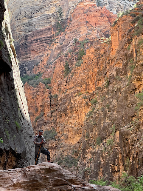
I felt like an explorer as you could not see very far ahead, so at every turn there was another turn just up ahead and you never knew what was coming up next.
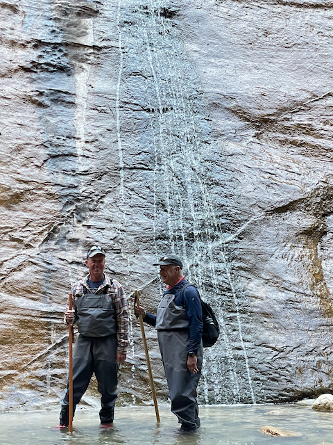
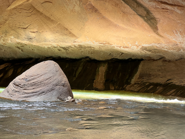
Our goal was to make it to the split and then walk a little further upstream to “Wall Street” where things get even more narrow. Which we did, we also explored a path to a waterfall. But that was not too productive, as there was a mini waterfall and boulder in our way. So we headed back.
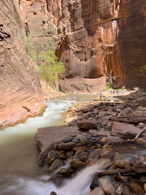
When we arrived at the deepest crossing that also had a very strong current that was when things went awry. I was walking just ahead of Jane when I saw her start to float by! She had stumbled and done a slow fall into the deeper water. I was able to grab on to her and get her upright but not before a bunch of very cold water had gone over the top of her dry suit bibs! Her hat started to float downstream but luckily some nice young person was there to stop it. When we got out of the water on the other bank we looked back to find that Ann had stumbled in the water as well.
The dry suit did an excellent job of keeping out the water for most of the trip, and now it was doing an equally good job of keeping the water in! Which meant that every time jane got into a little deeper water the pressure on the suit forced the cold water inside the suit to squeeze up! Not comfortable. At this point our hike became a march to get back to the trailhead as quickly as we could to get the women out of their wet clothes. Unfortunately Ann fell one more time in the water and then took a tumble on some rocks on the land and bruised her elbow and banged up her knee.
Despite it all we still enjoyed some awesome scenery along the way. When we arrived at the trailhead it was quite a process to remove all of our wet gear. I pulled open the cuff on Jane’s dry suit and a gallon of water came pouring out. We still had a one mile hike to get back to the busses which was just about enough time for their wet clothes to dry out.
We were all amazed and surprised at the casual nature of the outfitters in town. Here is some stuff, try it on and let me know if you need a different size. Signing the waiver of liability was totally on the honor system, and paying seemed to be an honor system thing as well. How they knew what we had taken or paid for, or even returned is a mystery. I guess a dry suit is not something you are likely to steal, but it felt nice and refreshing to not have to sign and number and carefully check in and out each piece of gear!
This is a hike we would definitely repeat with our family if we ever get back here again.
We arrived safely back at our campsite where we packed up some drinks and our swimsuits and headed to the east side of the park. We needed to get inside the geofence area to get in the daily lottery for a chance to hike the Wave. They only allow 64 people a day into the Wave so it takes some luck. After driving even further than we wanted to we finally got enough cell signal to enter. It was kind of funny with four of us and four different generations of iPhones each with different signal strength trying to get the recreation.gov app to work with only a single bar of LTE signal!
After finally succeeding in getting two of us in the lottery we gave up and headed over to Ann and Jerry’s hotel to use the hot tub! That felt great. Jerry offered to buy us all dinner if we could go to a sports bar where he could attempt to turn us into Phoenix Suns fans.
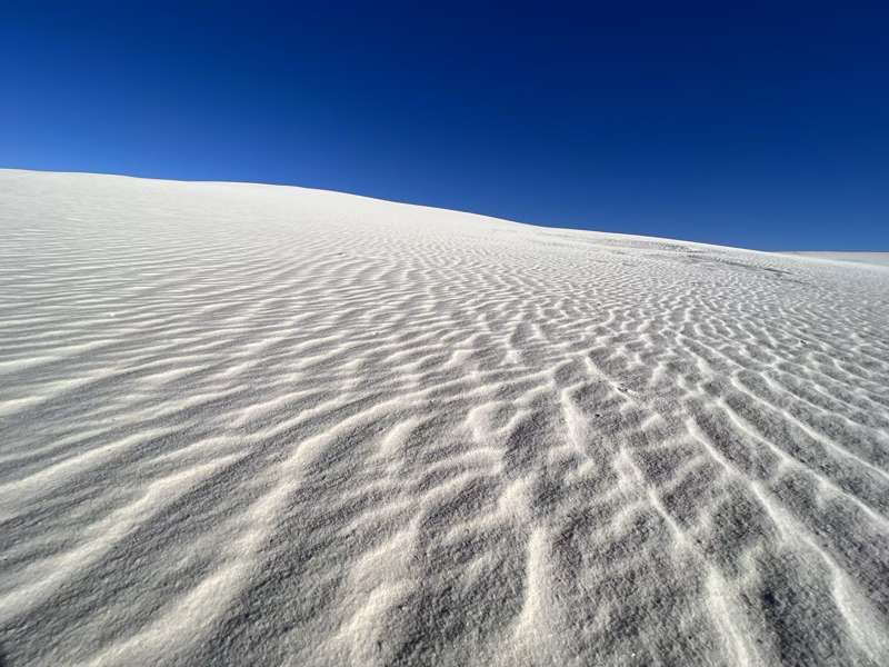
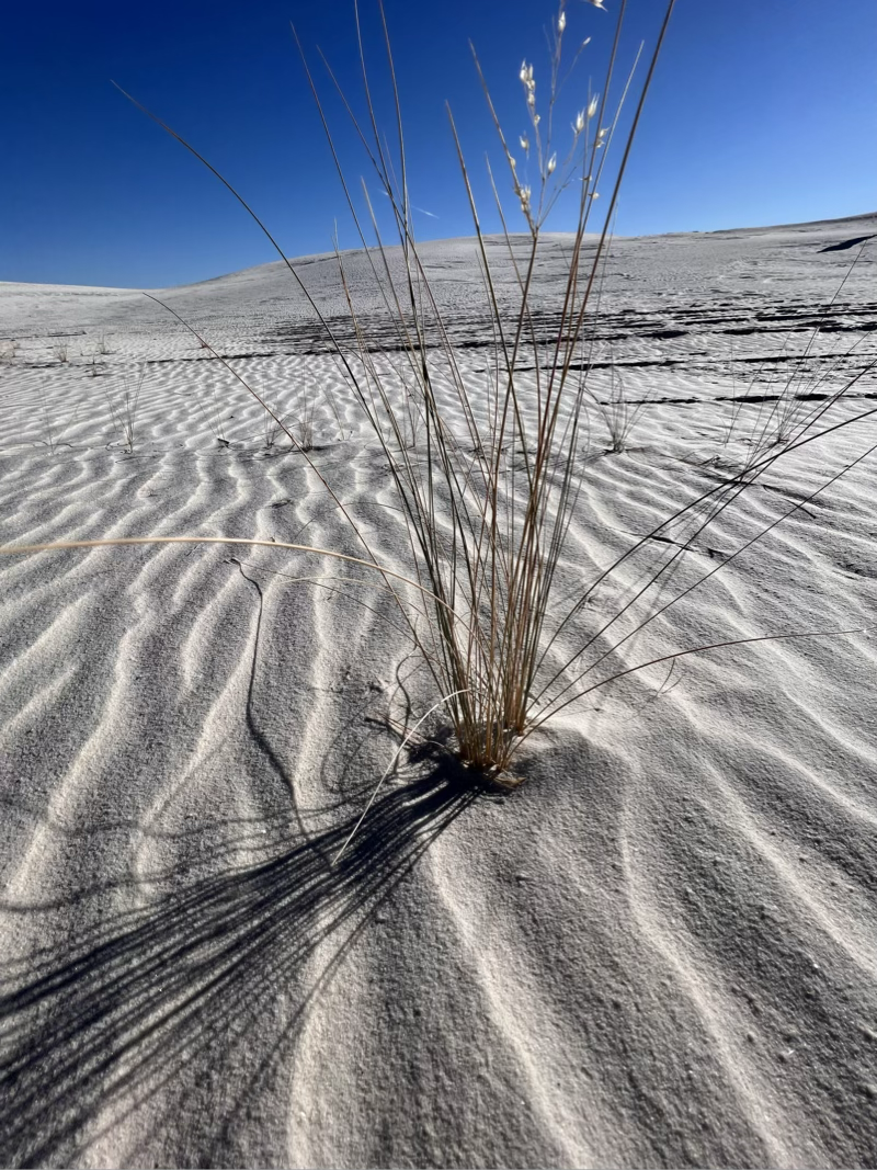
Winter Wonderland at White Sands
I was looking down at my phone or something inside the car when we made the transition. I looked up and saw this sight!
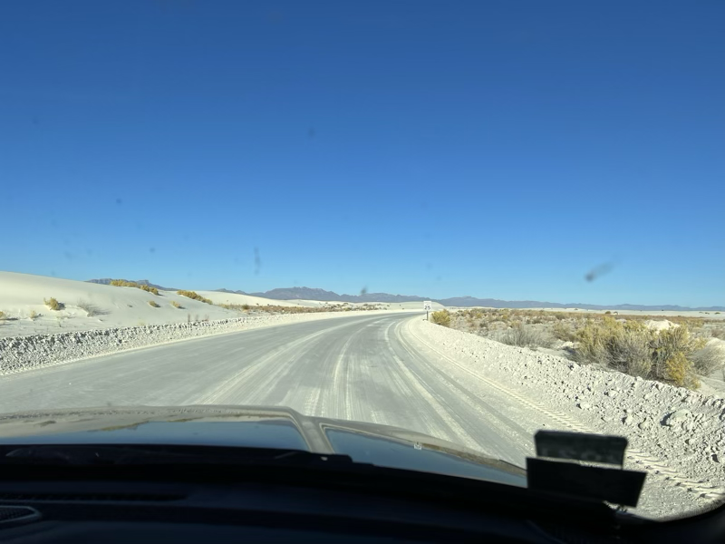
It looked like we had suddenly been transported to Wisconsin in the middle of January! Instead we were at White Sands National Monument in New Mexico. Not far from the Missile Range and the test site for the Manhattan Project.
We did some messing around on the dunes, enjoying the beautiful contrast between the white sand and the clear blue sky!
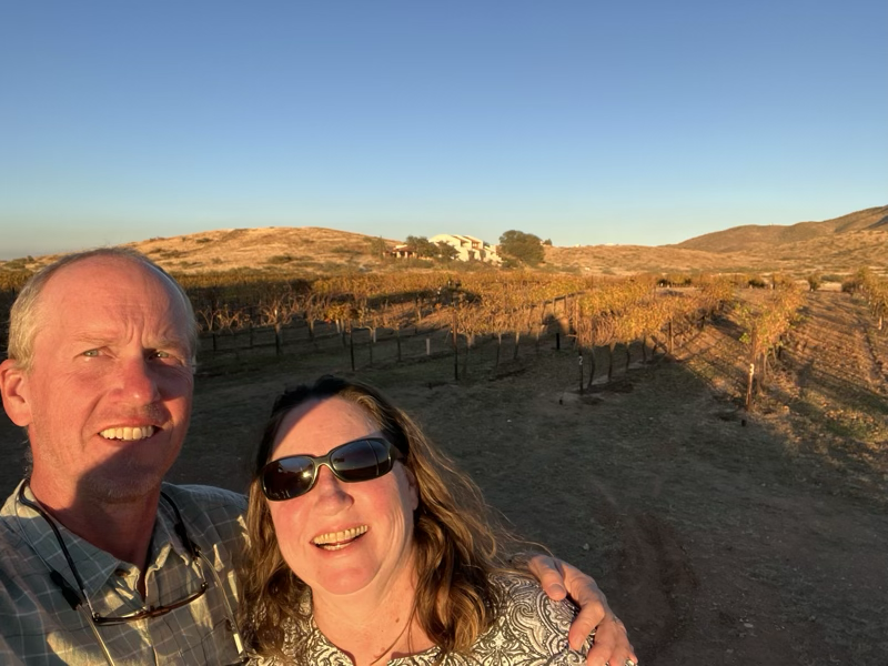
From White Sands we went back to our campsite at Leasburg Dam and hooked up to head further west. We had opted for a KOA in Wilcox AZ for the night so we could have all our tanks clean and empty for the final drive to Indio.
Little did we know that Wilcox is some kind of wine Mecca for the state of Arizona. Who ever heard of an Arizona wine anyway? We had to give them a try so after making camp and doing a little work with the good WiFi. We headed to the Coronado Winery to test a few wines and enjoy some of their food. The wine was actually really good, I ended up buying a bottle of their Rose to take with me and Jane bought a bottle of the Sangiovese.
Its been an incredible trip and all we have left is about six hours of driving on I-10 tomorrow! Depending on how early we get on the road we will be in Indio by early to mid-afternoon. Lots to look forward to there, and looking forward to reconnecting with all of our Indio friends, golfing partners and pickleball players!
Big Bend National Park
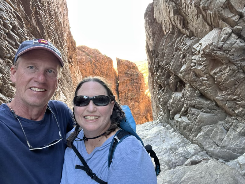
After a beautiful night at Seminole Canyon, we were on our way to Big Bend National Park. This is a good time to see this park as Big Bend is definitely not on the way to anywhere. The park is huge, and very remote. It borders the Rio Grande and has some spectacular hiking.
Getting into our “pull through” site was our first adventure. It was on the wrong side of the road for our camper so first we had to drive down the road the wrong way. The site is on a hill and half of the site is very sloped so we had to pull up to the level area and leave the pickup blocking the road until we were leveled and unhooked. Thankfully the rangers around here are very friendly and understanding. One even told us that he would block traffic for us when we left if he was around to make it easy for us to go the wrong way. I love a friendly rule breaker!
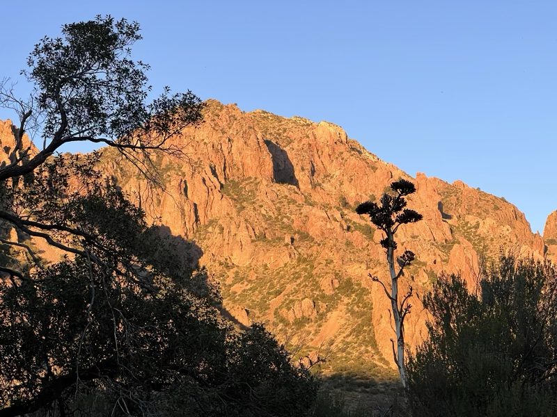
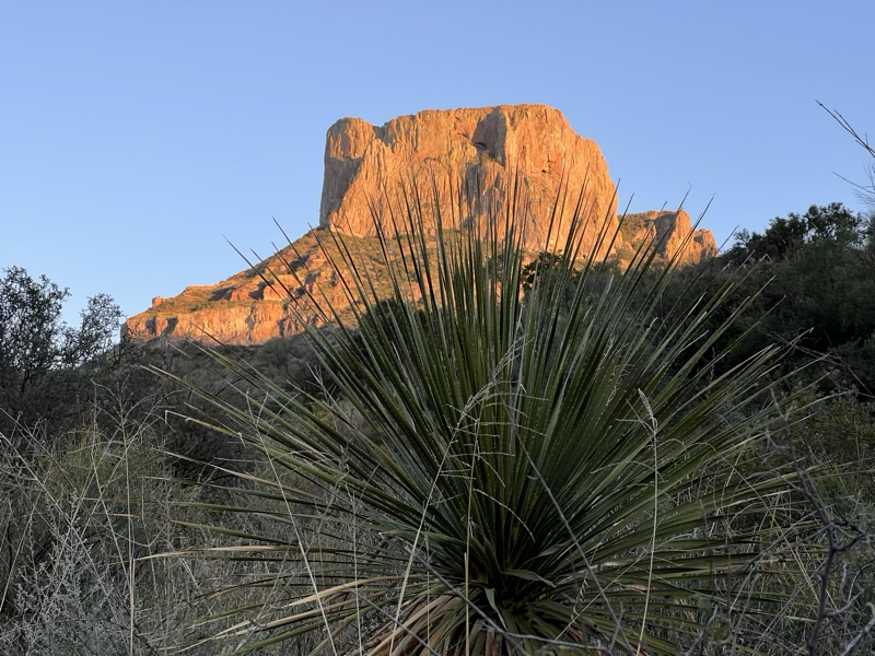
After some sandwiches for lunch I worked a bit and read with the idea that we would do the hike to the Window sometime after 4:00. This turned out to be a great decision as we ended up in shade for most of the hike and on the way back we had just beautiful light on the mountains. This hike was downhill from the start and uphill all the way back!
This was the end of the hike where we could see the plains below the window from our valley!
On the way back we had several opportunities to enjoy the beautiful lighting! This one is my favorite, I really love the reflection of the mountains beyond in this tiny pool.
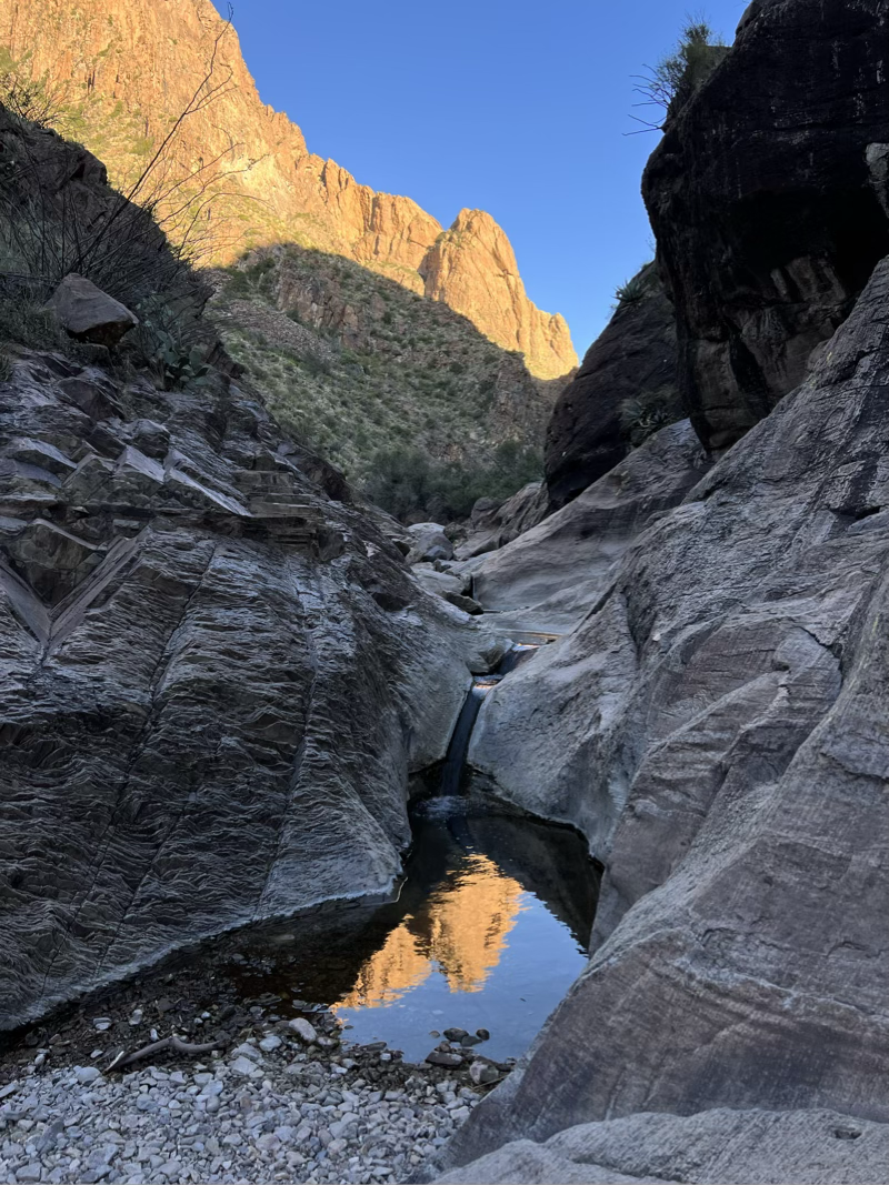
I also loved the contrast in the lighting, from the shadow we were walking in to the canyon walls still in bright, late afternoon sunlight!
We didn’t get back from the hike until after 7:00 so after a drink and a bit of rest it was dark by the time I started the griddle for supper. We had decided on fried burgers. I haven’t made a burger on a flat top in forever, but let me tell you, it was great! Nicely browned on the outside and we toasted some buttered buns right next to the burgers! It took me right back to my childhood having burgers at the Cafe in Storden Minnesota with my grandma Sundahl.
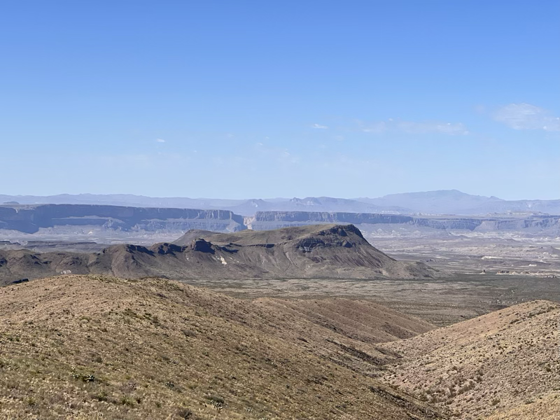
This morning we were up and waiting for the sun to clear the canyon wall so we could position the solar panels for the day before we took off on our sightseeing tour. It was great.
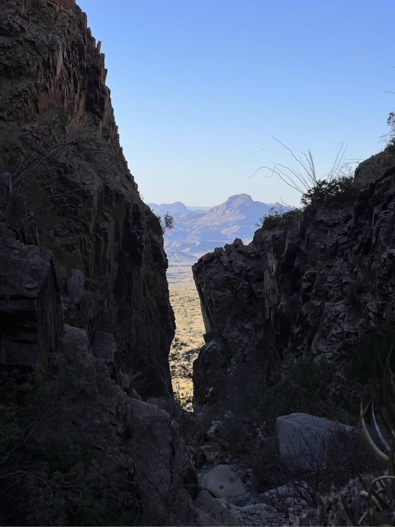
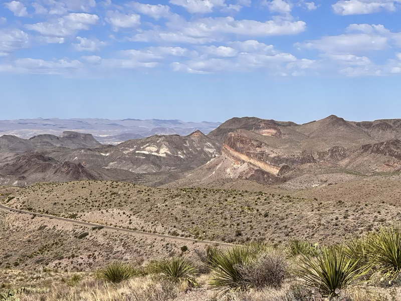
We followed the Ross Maxwell road (an early park super) and it was beautiful! The highlight of the trip was the view of “the notch” No! not the one on the iPhone or the new macbook pro, but a gigantic notch between the mountains carved out by the Rio Grande! This was our first view of it from about 10 miles away!
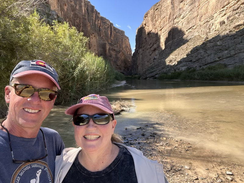
When we got closer it was great to get out and walk into the canyon. The drought is so bad that the Rio Grande is very low .
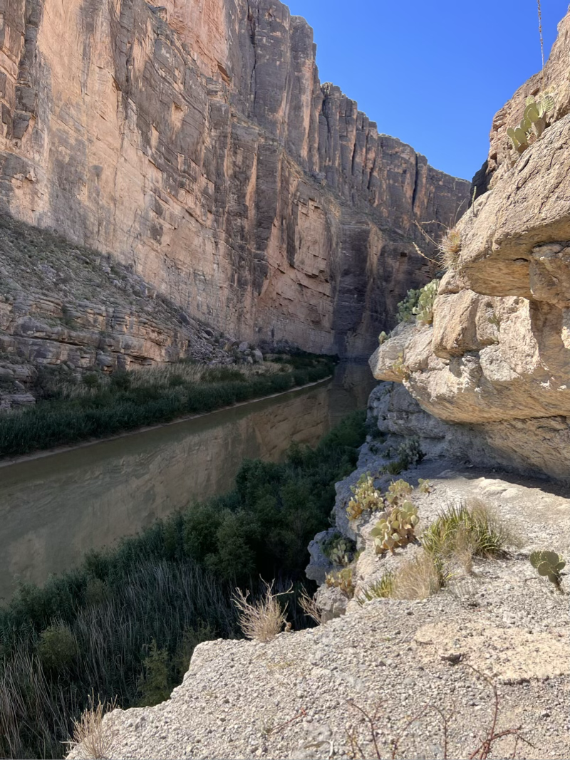
So low, in fact, that we were definitely in Mexico for a few minutes!
End of the Line - Riding the Delta
Yesterday was the official end of my Mississippi River ride. I rode way out on the delta to Venice, or the southernmost strip of land in the state of Louisiana. A few parts of the ride were scenic but a lot of it was still just along the highway. Thankfully the traffic heading out that direction is pretty light, so even though it was a four lane road I could have one lane to myself.
I got off to a bit of a rocky start as I thought I was just going to follow the highway, but a mile into the ride I checked the map only to discover I was off track. So I did a U-turn and headed back to my missed turn onto a nice side road. After a mile or so on the side road I could see a bridge ahead and the dreaded orange highway signs. The bridge was out! My only option was to go back to the highway I had left and continue as I thought! The highway bridge
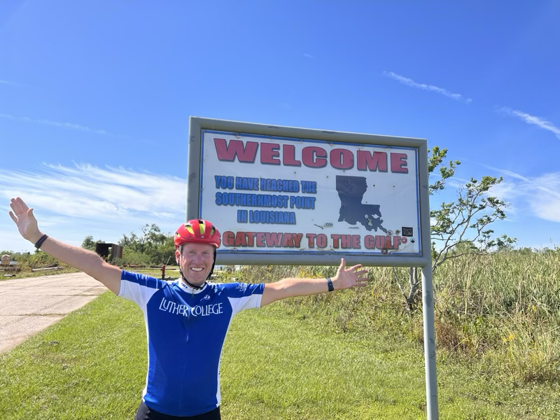
Miles later, and just a couple miles short of the end I could see our pickup sitting beside the road. Jane was waiting for me to give me the news that the road ahead was under water. Not deep, but definitely not bikeable.
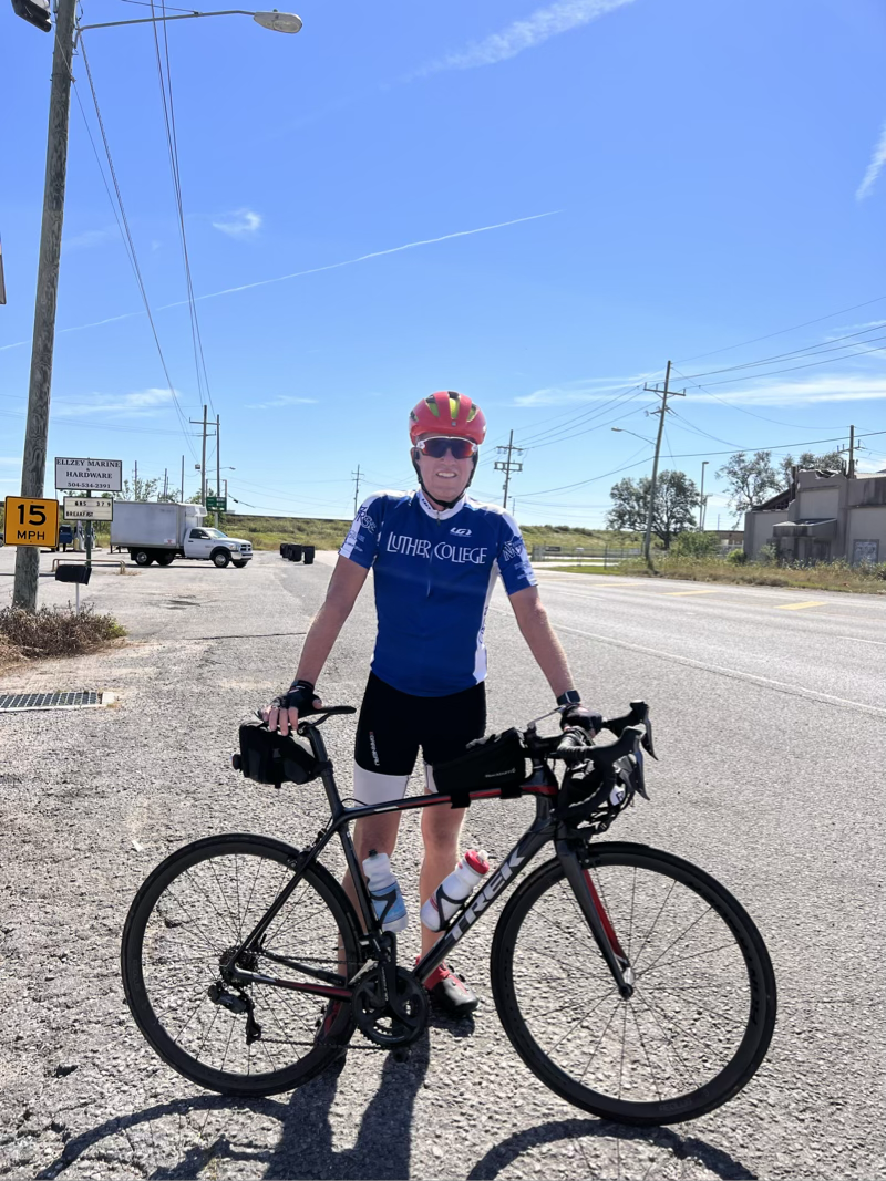
So we put my bike in the bed of the pickup, and fittingly drove the last two miles to the southernmost point in Louisiana where I did pose for my final photo op.
To recap, Jane and I covered 2,550 miles from the headwaters of the Mississippi at Lake Itasca to this pretty un-flashy finish line. I didn’t ride every mile of that but I rode the majority of it for sure. I learned a lot about the limitations of my body and the day after day grind of riding a long distance.
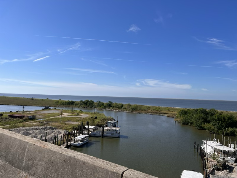
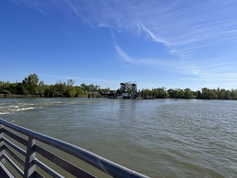
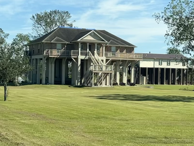
The drive back to our campground outside of New Orleans was pretty uneventful. We had to take a ferry across the river at the cost of $1.00. It runs every 30 minutes and appears to take about a dozen cars each trip. Definitely not a money maker when you consider the crew of three!
We really enjoyed looking at all of the large houses up on stilts! We even saw two entire high school buildings built on stilts! Very new, so we were guessing these schools were built with money from FEMA after Katrina. Here is a nice example of one of the fine houses we saw.
As I write this we are about an hour away from our campground in San Antonio! We have covered more miles today than we would do in a week while I was biking! We left early this morning under the cover of darkness and its been quite a trip. The severe weather that is affecting the entire country made no exception for our day of travel. We had to pull over to a rest stop outside of Beaumont Texas to wait out a severe thunderstorm. It was an early lunch but it worked nicely to park in between an 18 wheeler and a fifth-wheel camper.
We enjoyed 3 fun nights in New Orleans which I will cover in a separate post! We have about a week of travel left before we arrive in Indio with more adventures yet to come. We are looking forward to a visit to the Alamo tomorrow and some of the great national parks in the state of Texas.
Google Maps — You. are. Fired.
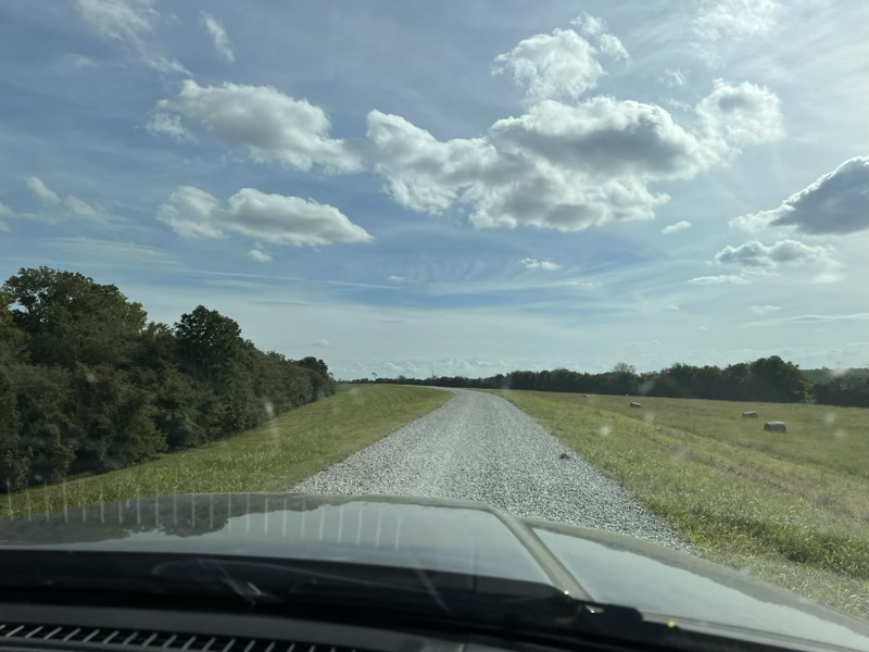
Due to my back pain I rode with Jane today from the Mississippi River state park to Lake Chicot state park. I’m not too sad as it was 80 miles of highway riding through flat (and mostly harvested) cotton fields was not so appealing.
After crossing the river into Arkansas we were ready to get to our campground. Google maps wanted us to turn right, so of course we did. The road sign for the state park said to go straight but hey, what do they know. A hundred yards later we were screwed…. We were on the North Levee road with no way to turn around. Think Gravel, dust, and steep grades on both sides of the narrow gravel road.
Crap! 7.2 miles and then we are supposed to turn left onto Audubon Trail. Which then goes to our campsite. What else can we do except take it nice and slow, raise as little dust as possible, and hope that nobody comes from the other direction!
Well, 7.2 miles later we get to our turn for the Audubon trail and that is exactly what it is! A trail! The road goes left but at the bottom of the levee is a gate, chained closed. I hop out to investigate and see if it is locked and what is on the other side of the gate. Well it isn’t locked but the other side of the gate has not seen any traffic in a very very long time. We would be driving in a pasture, with a barely discernible path. 100% something you would never pull a camper on!!
At this point our only option is to curse Google in the most colorful language possible, and try to very carefully turn the camper around by backing into the turnoff. Jane very skillfully backs the camper onto the ramp and then begins to pull to go back the other way. The wheels begin to spin. No way!! stop and go and spin, stop and go and…. the traction catches and we are turned around. Now all we have to do is drive another 7.2 miles back the other way on the same dusty gravel.
By the time we get back to the main road, the truck is beige instead of nearly black. The camper is covered in dust, and neither of us is in a very good mood. We follow the signs toward the state park and I thoughtfully suggest deleting the Google maps application from Jane’s phone. This way is about 17 miles longer than Google’s way but it is much better and we arrive safely. The ranger gives me a knowing chuckle when I suggest that maybe the park should have a notice to ignore Google maps when trying to get to the campground. We are not the first! Nor will we be the last I suspect.
We will follow the instructions to try to get Google to make a correction.
In the meantime for the search engine side of google here are some key words that may help the next unsuspecting traveller.
Arkansas Chicot State Park, directions, Audubon trail, north levee road, ignore google!! Audubon trail is NOT a road!!
Zooming to Tennessee
My back felt better this morning, and with 52 miles on the schedule it felt very doable. Especially with all my new ointments to soothe my muscles and keep my rear end happy.
The challenge for the day was that in addition to riding, and needing to move to the next campground, I was also supposed to participate in the Concordia College October board meeting. What to do? Most of the morning was scheduled as committee meetings and the student learning committee had no important votes to make today, so I decided I would ride during that meeting and attempt to participate via zoom as I rode. It mostly worked fine! I was able to listen to 90% of the meeting as I had at least two bars of Verizon LTE for the majority of the ride!
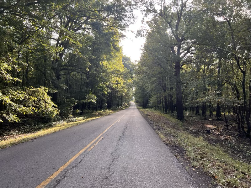
The only part I could not participate in was during opening introductions when I happened to be down in a very pretty valley — I guess they call them hollers down here in Kentucky? In any case I didn’t have service for a while.
I’m going to claim that this is the first time ever that a Concordia regent has participated in a board meeting, virtually, while riding 52 miles.
Tonight we are camped out at Reel Foot Lake State Park. We have a beautiful spot right on the lake.
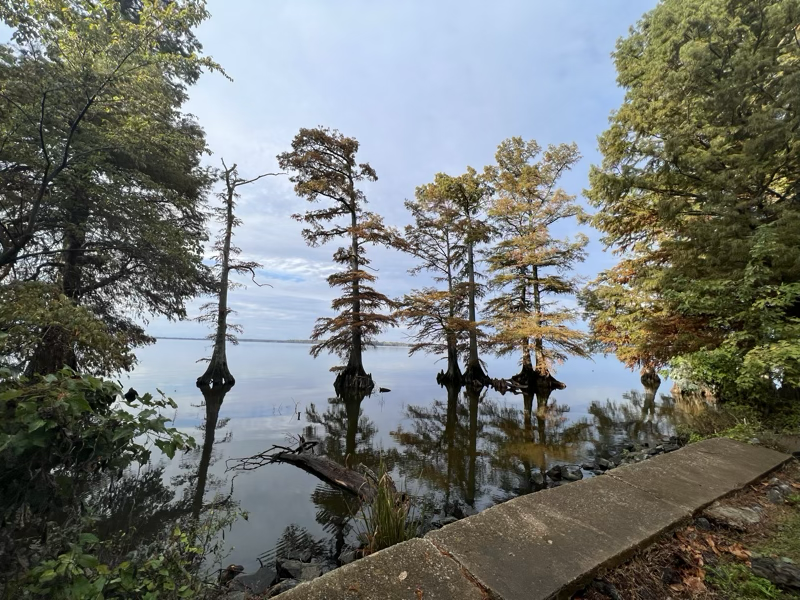
Getting into this spot was quite the trick! First we had to back down a lane and then make a sharp turn around a tree, while avoiding another tree with the pickup! Thankfully I married a pro backer upper, and with my expert hand signals 👉👈 we were settled in no time!
A relatively early arrival allowed me to participate in the afternoon session from the comfort of our couch, and thankfully we have a good signal at this campground!