Category: Longform
You are viewing all posts from this category, beginning with the most recent.
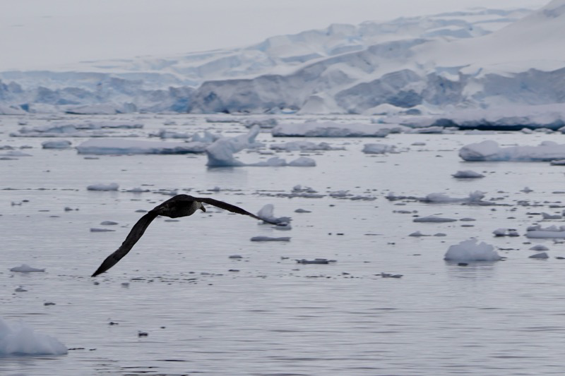
Yolaour Island
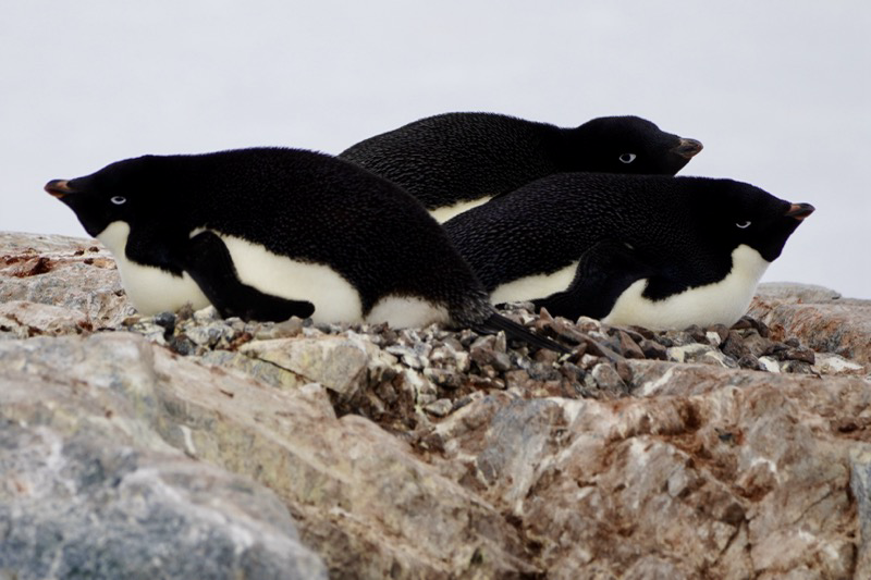
An easy afternoon to see some Adélie Penguins. So this is the third species of penguin that we have seen: starting with Chinstrap, then Gentoo (yes like the Linux distro) and now the Adélie. The Adélie is the only true Antarctic penguin.
The hike was easy and flat, and we were the first group this season to visit this large colony. We know that because our guides looked for a staircase from a previous ship and could not find one, so they had to dig one for us.
Our first bit of penguin drama came when the Skuas arrived. These are birds that are predators on the penguin eggs. They are very brazen predators as well, landing right next to the penguins laying on the nest! You can see it here with the one penguin looking quite alarmed, and the other just meekly pointing at the Skua as if to say “help?”

This guy however was definitely putting up a braver front! I got more of a “None shall pass” vibe.

But, the Skuas can’t be everywhere so there were plenty of additional Adélie to observe and enjoy their expressions. These three really got me.
Of course all is not just work in penguin land. I can’t imagine two penguins having more fun than these two little guys!

Finally, just a purely lucky shot. Our guide Ignacio has been talking about different techniques for composing shots and has talked about “frame in a frame.” I saw this from the zodiac heading back and thought it was a nice frame in a frame. It wasn’t until I got the photo onto my iPad and did a little cropping that I saw the Adélie in the middle of the frame!

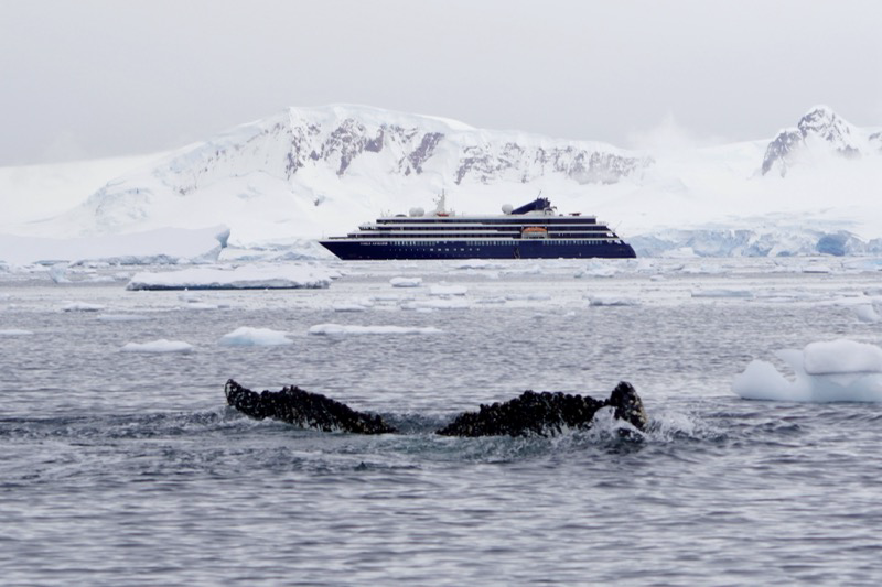
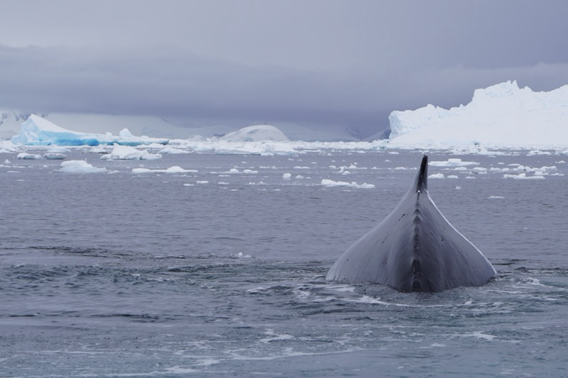
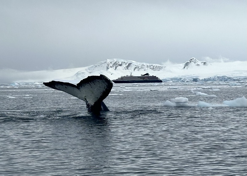
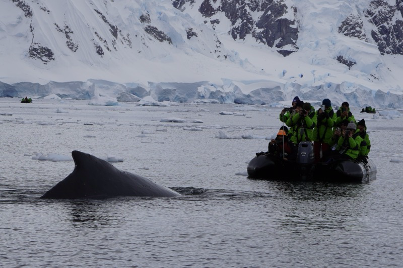
Flanders Bay
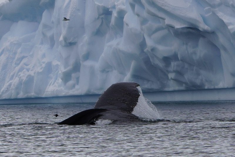
What started as an ordinary excursion turned extraordinary when we found ourselves surrounded by humpback whales!
We were just cruising through some brash ice and looking at some birds when we heard the radio call from Jonathan. “I am nine o’clock from the ship and have four humpbacks.” We quickly made our way toward his position, gliding in very quietly the last 100 meters.
Then we heard and saw them a short distance away. Breath going out the blowhole, whoosh. Sometimes they would just glide along the surface like a giant surfboard, sometimes they would arch their backs and slowly sink back under the water, sometimes they would dive and show their tails as they disappeared under the water.
At one point two of them headed straight at our zodiac. One went directly under the bow, the other surfaced on the starboard side so close we could have reached out and touched its barnacle covered skin. We have been whale watching several times, but we have never had an experience like this! So close, and the whales just seemed to be curious about “the intruders” into their beautiful calm bay. At some point I just told myself to put down the camera, put my hands in my pockets, and just enjoy this rare experience. Some memories will just have to live in my mind.
After returning to the ship and sorting through the photos from this morning I favorited more than 50! Gotta be a little more choosy for this post, so here you go.


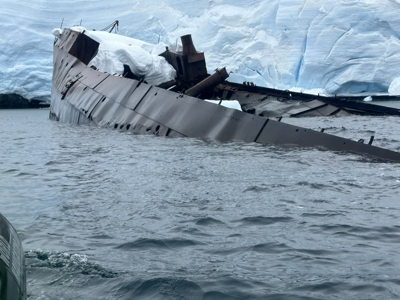
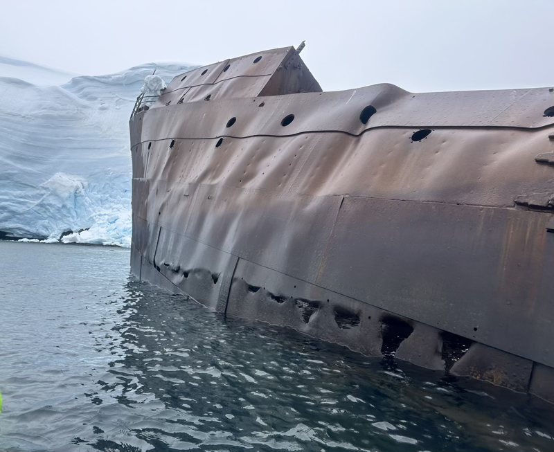
Enterprise Island
This morning the waves were larger than yesterday and the skies were much grayer. So we had another zodiac experience, but much bumpier and wetter than the previous day. While not as lucky as the day before, the highlight of this trip was to visit a Norwegian shipwreck.
Although called Enterprise island, this island was originally named Nansen island, after the Norwegian explorer and Nobel winner Fridtjof Nansen. (Yes, Luther friends, that one). But the British decided it would be better called Enterprise. The ship itself was here from Norway to help the whalers in the area stick it to the Brit’s. It had a processing system on board that would turn the whale blubber into oil, thus avoiding a particular British tax on whale blubber.
The pictures from this morning are all from Jane. I didn’t take our larger camera because we were warned that we and everything we took was likely to get rather wet. And it was fine, sometimes it is good to just take in the experience and not worry about getting photos every few minutes.
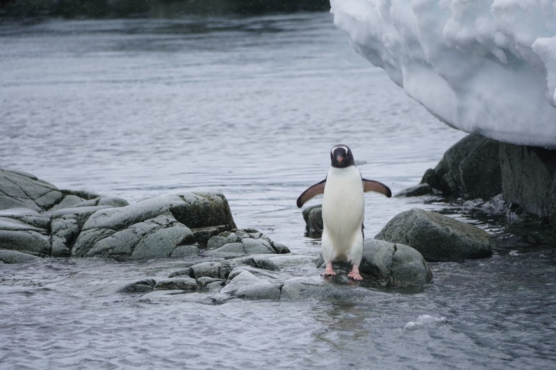
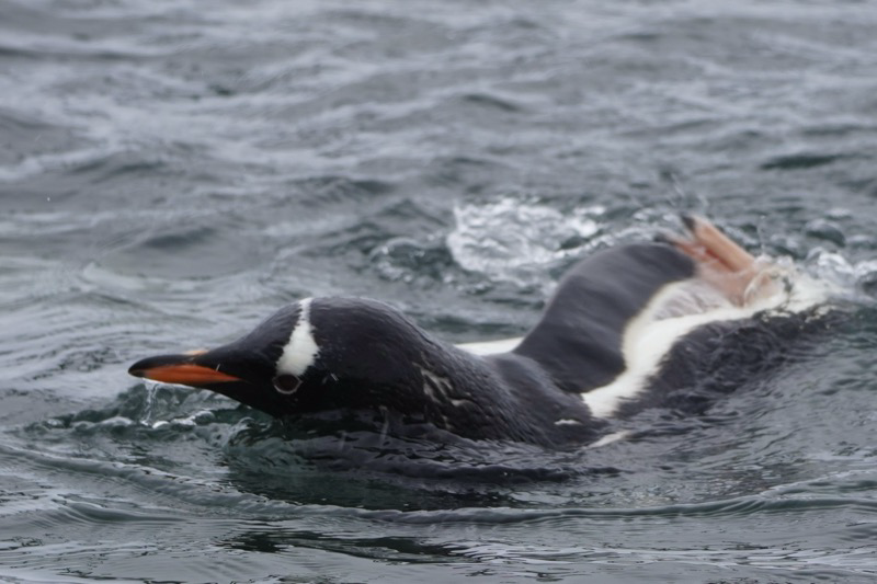
Useful Island
One of the guides is sponsoring a Haiku contest:
Cute little penguin
Penguin Personality
Penguins are stinky
We could smell the colony of Gentoo penguins long before we could see them. And then we were there amongst them all. The wind was blowing hard and it was snowing. It was kind of miserable to be honest. But we had come to see the penguins and we were treated to a show. We saw them sliding down the hill, or just “swimming” through the snow. Some were laying on eggs. If they are on the rocks and laying they are on their egg. Some were swimming in the water. Several of them jumped up out of the water onto the rocks right where we were getting off the Zodiac! Curious little buggers.
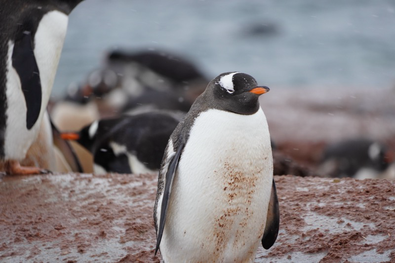
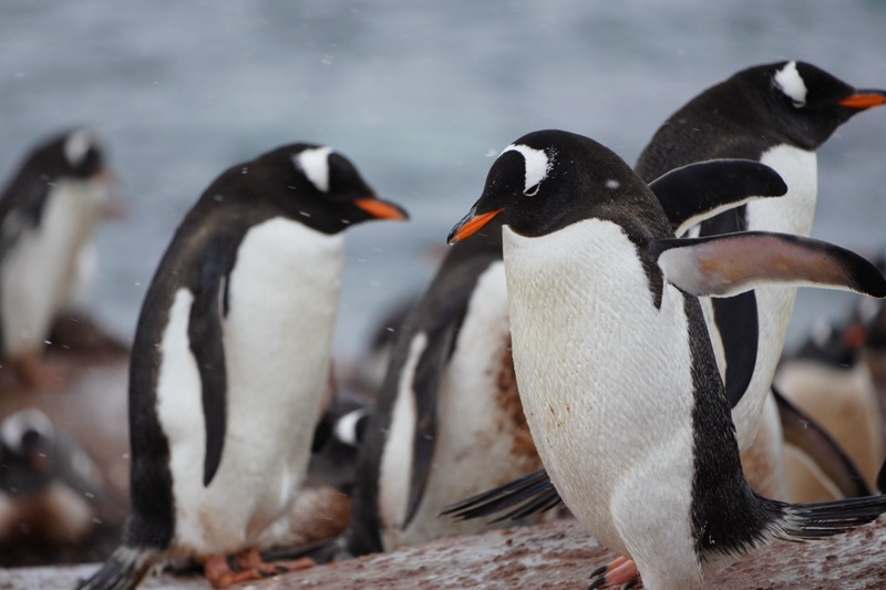
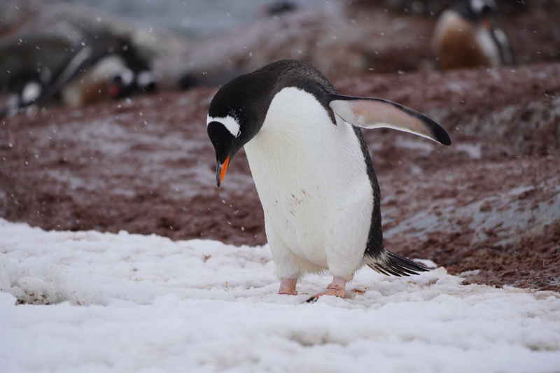
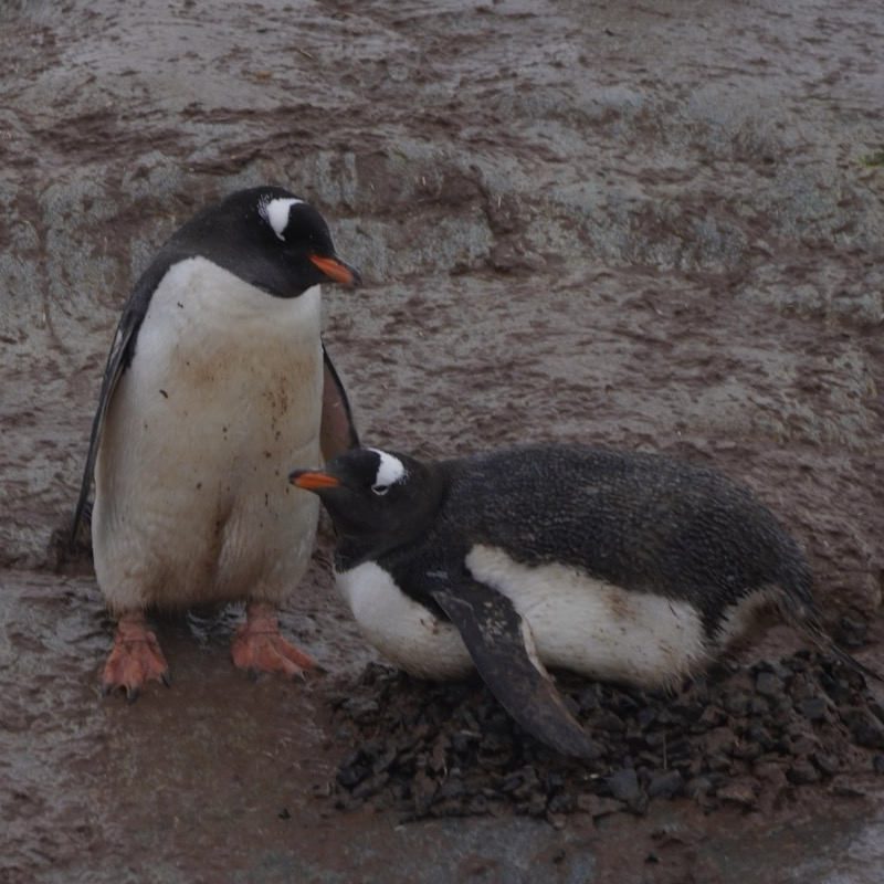
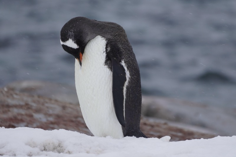
For an afternoon where the weather was not so good I have even more fun photos of these penguins.
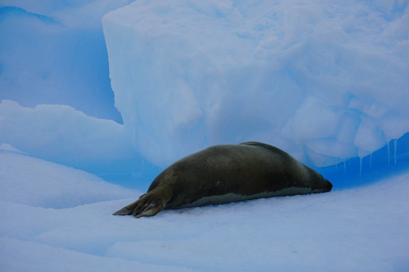
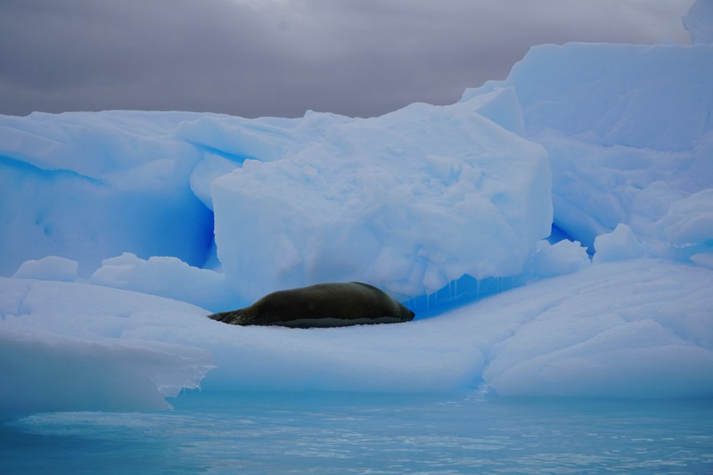
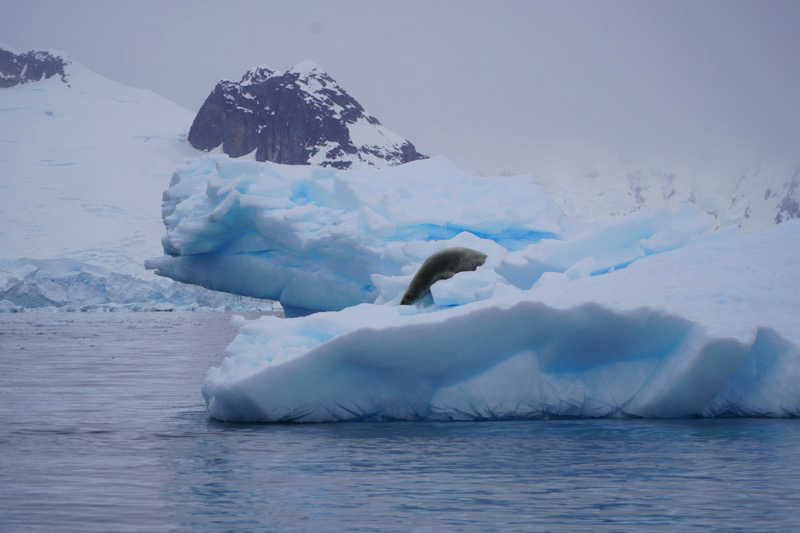
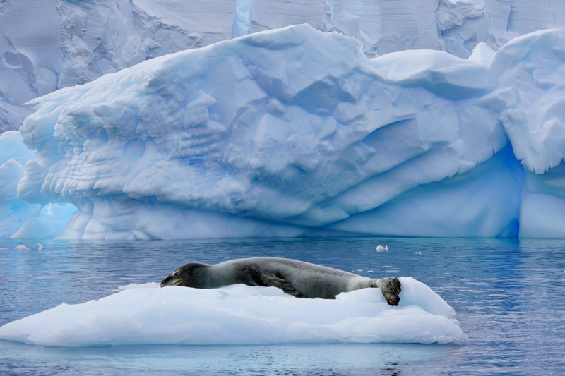
Recess Cove
This afternoon’s excursion was a zodiac cruise, rather than a hike. Everything we saw we saw from the side of the boat. We were lucky enough to have our Excursion Leader Jonathan as our zodiac driver, so we had a super knowledgeable guide for the trip.
The main highlight was a couple of crab seals. One was sleeping and molting, but another was awake and a bit more active and we saw him dive into the water. He resurfaced again and we were hopeful he would climb back on to his little iceberg but he decided to keep swimming. We learned that these seals have teeth that they can use to hunt seals, but they are all kind of trident shaped and when the seal closes its mouth it acts like a mesh. So a seal can gulp up a huge mouthful of water containing krill and then close its mouth, expel all of the water through the teeth, and it is left with a yummy mouthful of fresh krill. This is exactly what Baleen whales do on a much larger scale!
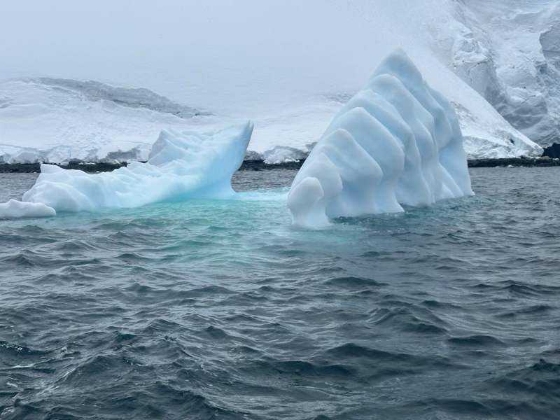
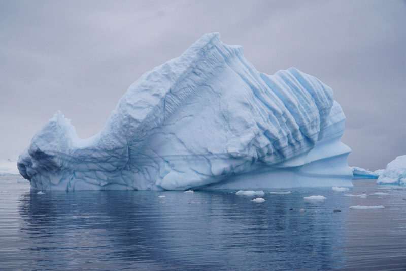
We also learned a little about how to read the history of an iceberg. Since the ice on an iceberg melts faster than the ice out of the water bergs will often rotate many times. You can see on this one how that is the case. They call the left of the on pictured below the keel. And you can see the rings on the right as well.
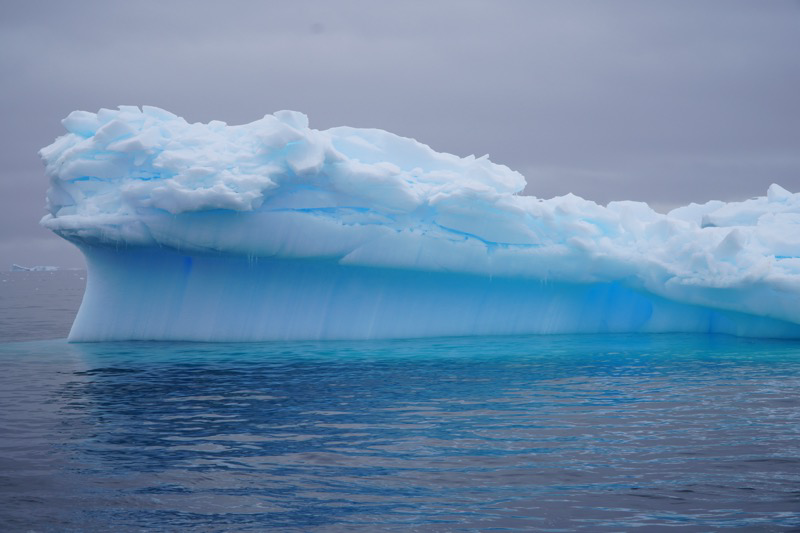
On this one you can see how the center of gravity has shifted more to the right, lifting the thinner part up out of the water on the left.
Today was really quite a day. The guides all told us at recap that we had been extremely lucky and we had seen about 75% of the things we were likely to see in an entire trip in a single day! Which was funny because I had just commented that if for some reason we suddenly had to leave today, I would still have counted the trip a great success. I’m glad that we will have more days to see and re-see so many interesting things.
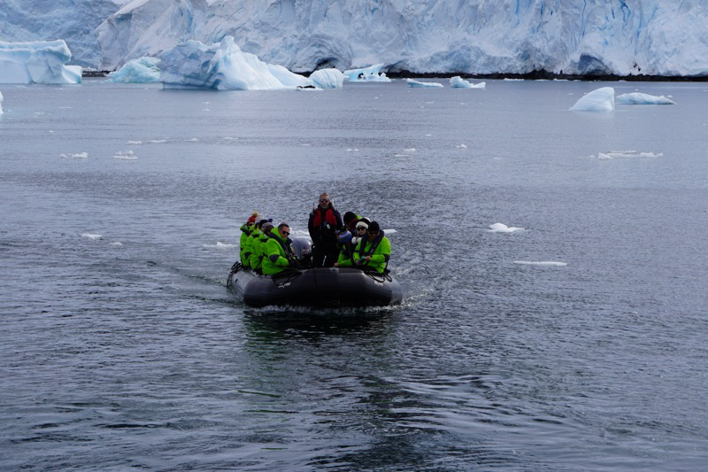
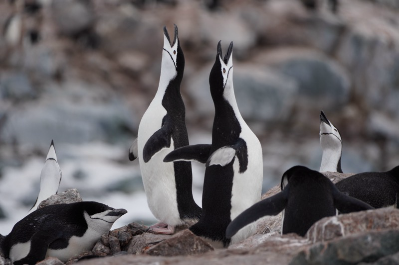
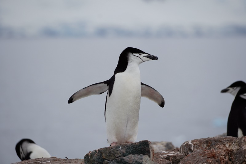
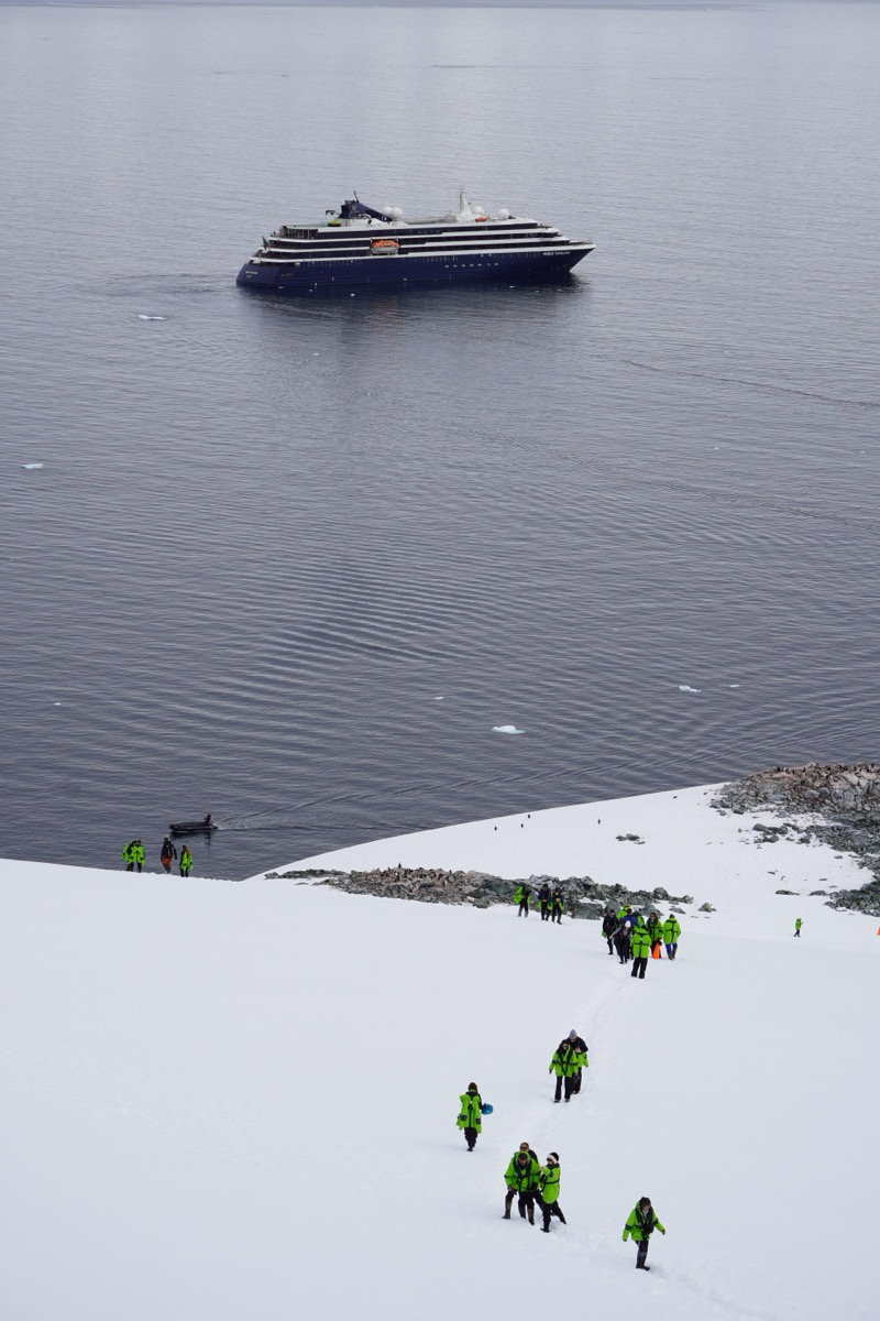
Palaver Point
Achievement Unlocked - seventh continent visited.
This morning was very exciting! We awoke to a sunny day, and very calm seas knowing that in just a short time we would be taking our very first hike on Antarctica. A colony of Chinstrap penguins and a little climb to a beautiful overlook. There were humpback whales, just chilling, off the bow of the ship. What a day!
We went through the drill of putting on our wellingtons and parka, hat, gloves, life jacket, backpack… I felt like the Michelin Man. We had our first experience with the automatic boot scrubber (to keep contaminants off the continent) and got onto the zodiac. It was a short ride, but the excitement began to build early when a bunch of penguins started jumping out of the water just ahead of us. Once we got on land there was a path to follow to allow us to see many views of the colony without getting too close. I’m definitely glad we invested in the new lens. We were well back from the penguins but the lens makes it look like we were much closer. So, walking in the snow, enjoying the views… There is not much more to write so I’ll just share some of my favorite photos from the morning.
Crossing the Drake
How many oceans are there on earth? Most of us learned about four - Atlantic, Pacific, Indian, and Arctic. But there is a fifth called the southern ocean that surrounds Antarctica. We need to get across it. This is also often referred to as the Drake passage. The winds have free rein to go all the way around the earth unimpeded by any content in this region. So, yeah, swells, big ones. And, uhhhhh seasickness for many many passengers.
I’m getting a little ahead of the story, but the early morning trip to the airport and the charter flight to Ushuaia were uneventful and pretty uninteresting. After arriving we took a motor coach tour of Tierra del Fuego, which was interesting since we had been there before with much more time to hike, so we kept trying to remember exactly where we had hiked. We pulled up to our yacht at 3:00 and were among the first passengers welcomed aboard. No lines, no reception checkin. Here’s a glass of champagne! Sit on the couch here and let me scan your passport and take your picture on my phone. OK, here’s your key, you are now checked in! We were scheduled to leave at 6pm but we were told that due to the holiday things were running behind. By the time we headed to bed right after dinner we were still in port. We were too tired to care, and we slept until 8AM the next morning. Between the time change and the lack of sleep it felt great.
At our first briefing of the day we learned that not only had we left late, but we had also picked up 20 passengers from our sister ship that was having engine trouble after passing through a storm on the Drake passage days ago. We learned more about our excursions off the ship and that the first three rules are “be flexible” The captain and the expedition leader work together to find the best, safest, most interesting landing spots for the day. With changing conditions that is often not known until hours before we are told and ready to go. We were so impressed with the expedition crew! Lots of specialties and advanced degrees in all kinds of fields will be leading us.
By the time of this first briefing we were well into the Drake and there were a LOT of seasick passengers. I know I am not immune to it, but I am lucky that I don’t get seasick easily, so far so good. Jerry and Jane have not felt the best but thankfully they haven’t got sick either.
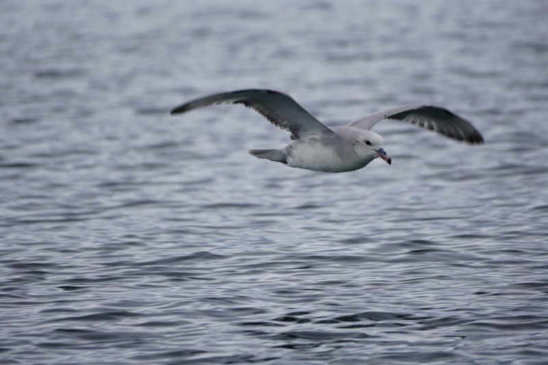
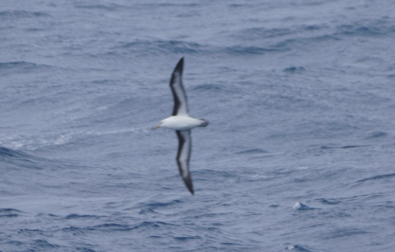
Later in the day we got fit for our parkas, life jackets and boots that we will wear whenever we leave the ship. We also had a fascinating lecture about the Albatross in the drake passage. This is the best place in the world to see them, and we have enjoyed watching them soar and dive amongst the swells. They can literally fly for up to 9000 miles without stopping. With their 12 foot wingspan they are some of the largest birds in the world. Unfortunately they are endangered. As creatures of the sea (they are only on land to breed and hatch and care for their young) they have been really affected by plastics in the ocean, and by bad fishing practices. Eat your seafood responsibly people! And, do what you can to reduce your use of plastics.
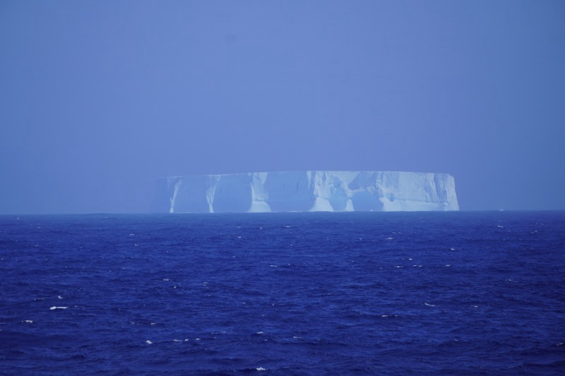
By dinner time we were all feeling pretty good. We had a very nice meal and enjoyed some after dinner entertainment by our cruise director before turning in for another good nights sleep. The winds and the swells were predicted to increase during the night, and that proved to be the case. We were definitely rocked and rolled to sleep. Waking up a few times as the bottles in the mini-bar all clanged together. During the recap briefing we were asked to predict when we would see the first iceberg. Not “bergy bits” or pieces of floating ice, but a real true titanic size iceberg!
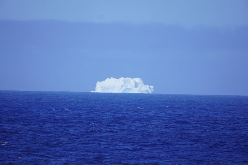
I didn’t expect to see one on day two, but there it was just after lunch! I was looking out the window of our room and for a moment thought it was another ship in the distance, but once I got the binoculars it was clear that it was a berg.
Of course the other side of the ship had an even bigger one to see!
We still have a good long distance to go before reaching Antarctica, but things are going to get more and more interesting.
Buenos Aires
We decided to splurge and book our overnight flight to Buenos Aires as Delta One tickets. There are some nice perks with that. Easy drop off of checked luggage and access to the Delta lounge while you wait. The seats lie totally flat for the overnight flight. Maybe we will be able to sleep, we thought. Not so much as it turns out. But we made it, having left Minneapolis at 3:00pm on Tuesday we arrived at 9 something the next morning in BA. An hour to get through customs and an hour to get downtown in a cab, It was pouring rain, the hotel lobby was packed with people waiting to leave on their Viking cruise. And our room was not ready, to be fair checkin was not until 3, and we were not the only tired travelers arriving on an overnight flight.
We had booked a bike tour to keep us going in the afternoon, but that was cancelled due to the rain. So we hung out in the lobby, watched some soccer, and had a light lunch waiting for our room or for our friends Ann and Jerry to arrive.
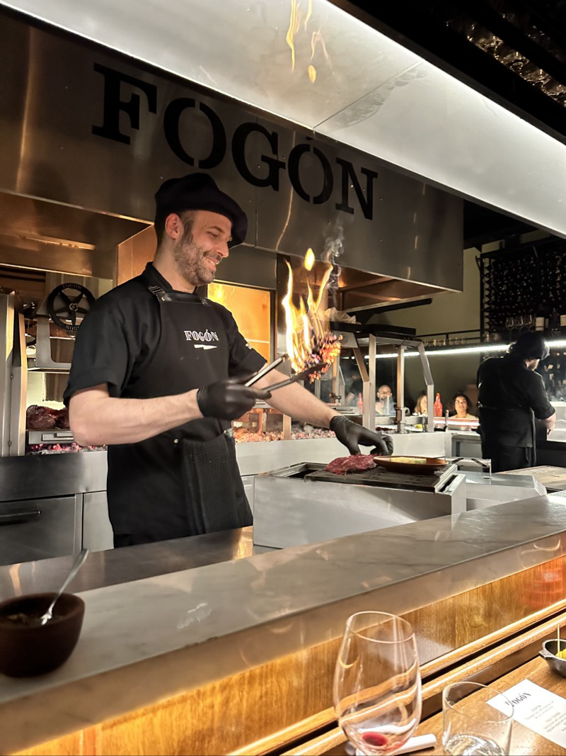
The highlight of that first day was the dinner experience we booked at Fogon. Everything is cooked with the highly elaborate Argentine grill called a perilla. There are 9 courses on the menu, but the 2 surprise courses brought the number to 11.
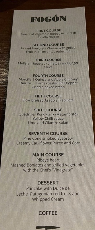
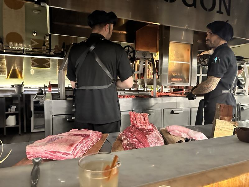
The chefs were all very friendly and very entertaining. The food was absolutely delicious and a celebration of being a wine loving carnivore.
Our dinner didn’t start until 7:30 which is very early for the Argentines, and it ended sometime after 10 when most of them are just getting started. We were glad to get back to the hotel and put our overstuffed bodies to bed for the night. We had an all day tour of the city booked for the morning beginning at 9:30. Note that Buenos Aires is 3 hours ahead of Minneapolis so we were not too jet lagged, but still quite sleep deprived.
The tour of BA was fabulous, our tour guide’s name was Fabio and he was both knowledgeable and an excellent story teller. We had lots of questions and he seemed to really thrive on our back and forth. Our first stop of the day was at the government center. It was a big day/weekend as they were inaugurating a new mayor as well as a new president. Our impression was that this new president was going to be a trump-like disaster for Argentina, but it seems most people remain hopeful, that he will be an influence for change but moderated by the legislature that he must work with. Democracy in Argentina over the years has not been easy with many coups and rebellions. I won’t try to recap it all in this post, but I feel compelled to re-watch Evita with a new perspective. We did see the balcony that Eva Peron and Madonna both used.
Speaking of Evita our second stop was at the cemetery where she is interred. Her mausoleum is one of the most visited places in the city. This cemetery is just amazing as everyone is in some kind of crypt or mausoleum. When a family buys a place there they own it forever, but if they stop maintaining the site then it begins to decay. So we saw many amazing graves and many that had been grand years ago that were now full of spider webs and weeds. It was like a small town all to itself with streets and avenues going all over.
Having had our fill of beef the night before we politely asked Fabio for a different option for lunch. He pulled through and brought us to a small family run place that made killer empanadas. By this time it was well after 1 and we didn’t finish lunch until 3. We still had one more stop on our tour!
The highlight of the final stop was a drive by of the stadium where the Boca Juniors play. The club of Maradonna! The blue and yellow colors of the teem seemed oddly familiar to me, and I’ll tell you why. It seems that there were two teams in the city with the same colors, and they had a match to see who could keep the current colors, the loser would have to choose new colors. The Bocas lost, and the owners declared that they would adopt the colors of the next ship to dock in the harbor. That ship turned out to be flying the Swedish flag!
It was 5pm by the time we arrived back at the hotel. We were going to have dinner, and then take in a Tango show which didn’t start until 10! On top of that our bus to the airport for our charter flight to Ushuaia was going to be leaving between 4:30 and 5:00 AM the next morning!! Sound a little crazy? Well, we made it through, and are enjoying a couple of down days on the journey to Antarctica to catch up on sleep. More on that in the next post.
The dinner was pretty forgettable, and 3 out of 4 of us enjoyed the Tango show. OK, the music was good, I just have never learned to appreciate dance. For me the show could have ended after an hour but it kept going for another 40 minutes with various flourishes and bows and a dramatic rendition of “Don’t cry for me Argentina” to wrap up the show. It was after midnight by the time we walked back to our hotel, and yes, the alarm needed to be set for 4:15AM. There will be time to sleep later.
Mesa Verde
Today started out with another harrowing drive. We received about 3 inches of snow overnight, so my first duty was to clear the snow off the car. The snow was melting off the streets and it was warm enough that I really wasn’t worried about the drive. Until we started up the million dollar highway, on snowy, icy, roads, with no guard rails! We were doing 5-10 miles per hour on some parts. Luckily once we reached the summit things improved dramatically, but it was a very long first hour of driving.
The highway was built in the 1880s to connect Silverton with Ouray. It is supposed to be stunningly beautiful. Hopefully we can return in the warmer months to find out.

From Silverton we continued on to Durango and then Mesa Verde National Park. It was a great time of the year to visit as the crowds were pretty small. The downside is that the ranger led tours of the cliff dwellings had ended a few weeks ago. Still, we were able to see a lot of the detail of the construction extremely well.


Mesa Verde, Machu Picchu, and other ancient constructions always astonish me. How could they have done all of that building? So much progress in engineering that seems to have been lost. What happened?
Westward Migration
Today began just North of Denver, dry roads and a cloudy sky. We had coffee and got our day started, we were on the road by 8:00. Our path today would take us to Ouray with a stop at Black Canyon of the Gunnison National Park. Not our usual route out of Denver, up I70, but rather down US285 and over Monarch pass. Not more than 20 minutes down the road the conditions changed drastically. Cars in the ditch and ice on the roads. We slowed our progress considerably and soon the ice changed to water, but the skies got cloudier and the snow started. The conditions were not too bad until we climbed up toward Monarch pass. A pickup (pulling a camper!) had slid off the road, we slowed way down and joined a line of other like-minded travelers.

Once we were over the pass, the temperatures warmed above freezing and the roads thawed and the sun came out. We paused for lunch at the Alpine Brewing company in Gunnison. We continued west toward Montrose but took a detour slightly North to take in Black Canyon NP. It was cloudy and we could hear thunder in the distance. Its odd to look down on the clouds in the Valley.

I kind of felt like maybe I could hear the dwarves from the Lord of the Rings.


The thunder got louder and closer, and before we knew it it was sleeting like crazy. In less than five minutes the roads were completely covered in slushy ice. But once again as we descended slowly the roads cleared.
We continued on our way toward Ouray and were treated to a beautiful sight as the clouds briefly cleared.

Our evening in Ouray was pretty uneventful. We walked around downtown, but it was pretty quiet as it was cold and rainy. We had dinner at Brickhouse 737 in Ouray and it was a great meal. Quite a nice change from breweries and other on the road meals.